Categories
Touring

Emerald Bay Chutes, Lake Tahoe

Lake Tahoe is California’s premier summer playground. Flooded with tourists longing for beachy days, boozy boat rides and immaculate mountain views, it can be a challenge to find solitude in these mountains. Winter, however, is when the real magic happens. Luckily for Mark and I people seem to shy away from the piles of snow and cooler temps of winter.

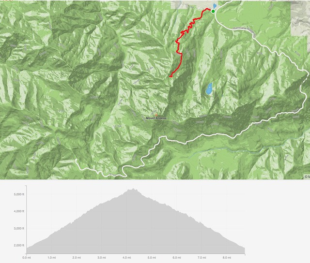
Despite the cold and stormy weather that had defined the season, cold temps were not in store for us. Lows were lingering around the high 30s and 60 degrees was going to be our top end temp for the day. With an understanding that quality snow was going to be hard to come by, we headed south from Marks squaw valley residence toward Emerald Bay. The goal was to get to some views and find a chute that’s rarely in due to waterfalls and cliffs at the terminus of the route on an average snow pack year. Average is not a word we’ve been using this year here on the west coast.

With over 600” of our favorite substance deposited by mid march, the Emerald Bay Chutes were fully in. We hoped it wouldn’t get too sun baked but when we arrived at the TH at 9:30am a couple had just come off the main descent from Jakes peak and said it was already punching through.

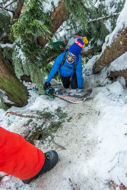
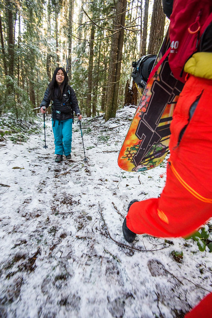
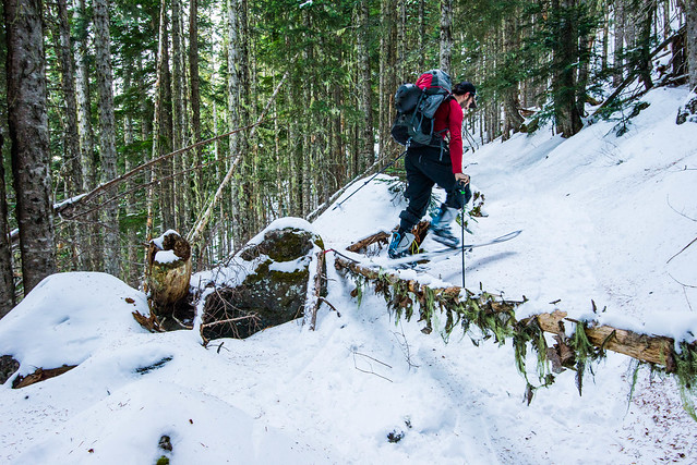
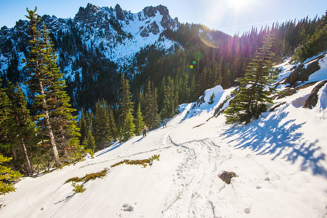
We started up the first pitch which was mellow and gained about 800′. Very easy cruising and no real skin track to follow as there were tracks running in every direction. Choose your own adventure.

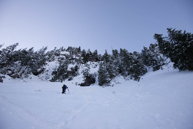
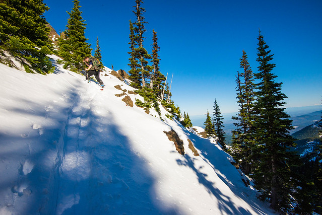
After contemplating a route up and through some trees, an avalanche path seemed to be the most direct and avy danger was low. Wet loose was the only concern and given the terrain below we weren’t concerned about being carried a little ways if something small were to peal off. We opted to boot up most of this pitch to attain the saddle between Jakes Peak and Peak 9195′. Only a couple hundred feet of vert separated us from our peak.

Our line was along the south ridge of Peak 9195′. We’d scouted the two chutes from below and I was hot on the one further south. Mark and his new, untested boots were pushing for the more mellow north line. We made our way down to the south line to have a looksy. While on top of the glory run we had a conversation and agreed to boot back up the ridge and go for the more tame line.

Just as we unclipped to head back up the ridge, 4 skiers came tearing down towards us. Mark yells “Hey Kioki!” It was one of his ski cinematography buddies from decades ago. It seemed everywhere we went Mark knew someone. Luckily for me, Mark was easily persuaded after watching this crew go for the line.

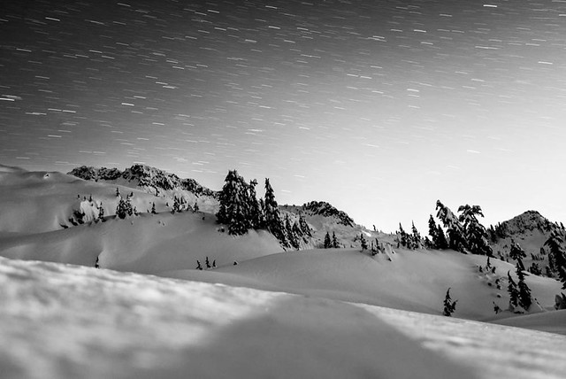
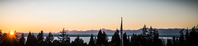
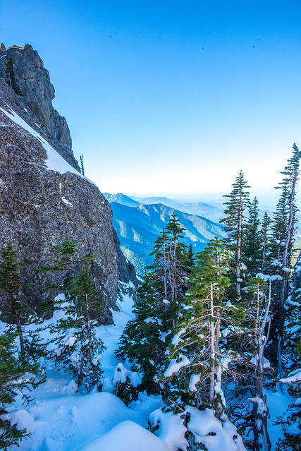
The first couple turns were steep. Pow turned to unconsolidated mush seemed very challenging on skis. On the board I felt like I was surfing. Sub optimal ski conditions would not be the conversation piece regarding this line, however. With views of desolation wilderness to the west, Lake Tahoe and Emerald Bay to the east, it’s hard to find a zone that’s more aesthetically pleasing.

Sheer granite walls on either side gave us a wide enough chute to surf the walls of snow that had been peeling off the rock through the season. It was essentially a wide and steep natural half pipe for much of the 2000 vertical foot run. As we spit out the end, the water was roaring underneath the snow pack and it was clear that the cliffs and waterfalls would be exposing themselves within the next couple weeks.

Full of cheer, we gathered around Kioki’s van and peeled open a beer. This tour certainly left me wanting more form the region. It’s all about timing with this one but if it’s in, it’s on!

Categories
Touring Movies Central Cascades

Cashmere Mountain, Questionmark Coilour

It was with variable spring weather in the forecast that Tim and I started game planning a Sunday tour. Originally looking at the goat rocks region, notice of a washed out road changed our plans. We started looking east and found decent weather as close by as Leavenworth. With icicle creek road bare and dry we opted for a tour off its flanks. Cashmere seemed to be a good option. We tied up the hiking boots and headed up toward Lake Victoria from FS 7605 (elev 2400′).

After getting out of the lowland brush, a sweet couloir off the north ridge of Cashmere mountain presented itself. It seemed complicated though. Aside from questions of whether the thing even got us off the rock face, Victoria Creek had started roaring with the snow melt and would possibly separate us from being able to get back to the trail.


Tim eyes up the couloir to the left, Johnny V scouts the trail


Another angle on the couloir

We kept booting until we hit a reasonable snowpack at 4700′ and tossed the hiking boots for the snowboard boots. Skinning was challenging at parts with a lot of melted out terrain. In hindsight, skinning would have started around 5000′. Scratch that, in hindsight we would have brought our downhill boards. We booted more that 75% of this thing.


Definitely patchy in places

Eventually we hit the creek crossing with substantial snow bridges. Not long after we arrived at the lake. A couple of our friends were snow shoeing with us with plans to chill at the lake eventually meetig us at the car. We had become confident enough in the couloir route so we headed left at the lake and on up. Straight up.

Snow conditions made skinning incredibly difficult so we booted up to a ridge. At this point we noticed the weather coming in from the west. Things would be questionable without visibility. We picked up the pace and topped out at 7100′ just as it started snowing. The sun was still shining though, and we could see the very broad entrance of a couloir. It seemed like it went, but it looked much broader than the one we were after.

With time running out, we boarded up and got ready for our decent. We started down a ridge and I went skiers right to see if I could find the coulior we were after. Nothing that direction. We then debated dropping into the large coulior. After a bit of discussion we realized this had to be it. After booting back up a little to the entrance it was go time. Once we dropped in it was apparent we were in the right place.

The snow was very firm once inside. Lot of chatter on the way down until we found some sun ripened corn. Super mixed conditions all the way down but what a blast. It was steep and adventurous. At one point there was a 30 foot cliff where the snow had separated from the rock forming a schrund. The gap was jumpable but not by much. The rest of the way down was fun, but that’s when the real fun started – find the exit!

Quick edit of the decent:

We traversed to Victoria creek which sounded rageful. Luckily for us there were plenty of downed trees that acted as sketchy bridges. The traverse to the trail was heavy with brush, lots of bushwhacking. With some hootin and hollerin we heard our friends Brandon and John in the distance. We found the “established” trail but they were still off to the left, buzzin through the brush. The trail can be hard to find at times. Eventually we all linked up giving Tim and I a chance to change out shoes. A rainbow appeared along with the drizzle of rain giving us the gamut of weather we often see in our lovely maritime ranges around this time of year. Great tour, would love to rip questionmark coulior again in the winter!

Bonus TR: RICO’S PIZZA

If you’ve ever driven westbound on highway 2 over Steven’s Pass toward Seattle you’ve seen the sign. You’ve seen the establishment, sticking out like a sore thumb. But you probably haven’t been inside. With so many friends aware of this place, having passed by hundreds of times, and not a single report of a visit to this legendary place, we had to engage our curiosity. Results – Very good pizza, definitely worth a visit.

Categories
Touring Central Cascades

Mount Pilchuck NYE 2015, Non Standard Route

It was cold when we left the city, and even colder when we pulled up to Heather Lake trailhead for our New Year’s Eve adventure. The goal: summit Mount Pilchuck via the non-standard northeast route.

Pilchuck TOPO - non standard route
– The Non Standard Route

The day started off with driving decisions. The gate blocking the road up to Mount Pilchuck trail head was still open (it is now closed), but the road looked ugly and caused us to turn around quickly. If you had a pickup or jeep with clearance you would have a shot.

So we parked at the Heather Lake lot and started skinning up the established hiking path around 9AM. We immediately ran into an issue. There were large trees that had come down, blocking the trail and making it excessively difficult to travel on skis. I had earlier proclaimed this would be the trip in which I would monitor my body temperature diligently and not sweat. Optimism is one of my quirks.

DSC_3425
– Tree Tunnels!

The trees only lasted for 0.5 miles then the trail cleared up for easier travel. Within two hours we had reached our first objective, Heather Lake. At this point the trail ends and the route-finding begins. After considering Bob’s Couloir for a minute, we opted for a different couloir just to the northwest.

DSC_3526
– Looking up at Bobs

It looked gentle enough. Soon though, we happened upon some cliffs and had to navigate up, through, and around. At this point, kicking steps took approximately 9-10 strikes each time because the snow kept sloughing off the cliff. This was very sketchy and not recommended in early season. With another 2-3 feet of snowpack it would be a reasonable objective for a competent skier.

DSC_3590
– Gearing up for the NNS Couloir

After topping out on Never Not Stopping Couloir (we named it) and attaining the ridge, we ate food, boiled some water, and kept going. This next section was also interesting. It was true north facing and had some deep snow and beautiful ski lines. Unfortunately we were still headed up and the beautiful ski lines made for difficult skinning. Also note there are many cliff bands in this section and the topo map likely needs to be updated. To get through it all, I recommend traversing west for 0.5 miles after the ridge and then heading up the mountain through some notches in the cliff band. You’ll have to maneuver a bit here but it goes.

DSC_3634
– Traversing through fields of pow!

Soon we came upon the snow field, where we got our first views of the summit and the second party in our group who were heading up the standard route. By this time we were about 8 hours in, it was dark, and we had to use headlamps as the moon had not yet risen. After eating and debating stopping, we kept going up the snowfield. Travel was fairly simple as we found the ridge again and followed it up to the summit block.

DSC_3649_edt
– Scott & Tiff killin it on the other side of the mountain.

The final effort required traversing underneath the summit block and boot packing up Gunsight Couloir (east facing). It’s fairly steep, but the snow was good and it went smoothly. We topped out on the summit ridge at 10 PM. So if you’re doing the math it took us 13 hours up in total. I think we could have done it 2 hours quicker with more snow on Never Not Stopping Couloir and the subsequent snowfield. Nevertheless it is a long day.

DSC_3696
– Nerve endings on the toes took a bit of a beating on these boot packs.

The best part of the climb, though, was our friends waiting for us at the fire lookout with smiles, christmas lights, adult beverages, and open spots on the floor to sleep. We watched the new years eve fireworks splash across western Washington at midnight which was a nice distraction from what was going on to the north east, Aurora Borealis was in full form behind us beaming up over Three Fingers and dancing across the sky towards Mt Baker.

DSC_3754
– Friends!

DSC_3718
– Fireworks

We descended via standard route the next day, which was mild skiing, but recommended if you are low on energy.

Upon full reflection, the non-standard route was a blast. I wouldn’t trade this trip for any of them. 2016 is going to be good

– Tim Patmont in collaboration with Charlie Coultas

Categories
Olympic Mountains Touring

Hurricane Ridge… er, Heather Park, The Olympics

After a nice Thanksgiving I was presented with the opportunity to stay on Bainbridge Island, halfway from my home to this week’s destination. We set out at the crack of dawn for Hurricane Ridge with the plan of ski touring. The snow conditions were promising with infinite visibility – vistas of Baker and Mt Rainier amped our stoke levels as we drove toward the Olympics. And then there they were. The beautiful Olympics finally enjoying their winter coat after being totally bare for a few months during our west coast drought.

DSC_2812

We got to the Heart of the Hills ranger station gate around the scheduled opening time of 9 am. Roads were icy and we were informed that the sand truck had broken, with a road status update coming at 9:30. The ranger seemed to be letting us down softly so we began backup planning. Our most knowledgeable team member of the Olympics came up with Heather Park as a backup destination. After relocating the cars we geared up with our setups on our backs, starting at the Mt Angeles trailhead (elev ~1800′) just off the Heart of the Hills campground.

DSC_2884

After 2.1 miles of hiking on top of a dusting, two of us went into tour mode at a landmark known as Halfway Rock (elev ~3200′). The other two carried on booting up the well defined trail. Hard to say which method was more efficient but it was nice to get the weight off the back.

DSC_2934

After a mile of touring I realized I had skipped brekkie and the day before I consumed the smallest thanksgiving meal in the history of thanksgivings so I was bonking hard. After injecting about 100 grams of sugar I pushed my way up to meet the rest of the crew up on a saddle between First Top and Second Top (elev ~5500′) near the heather park shelter. We never saw the shelter, not sure if it still exists.

DSC_2952

The views up there were great, And given more time we would have pushed on to Klahanee Ridge.

DSC_2959

The snow on this particular day was excellent. The top section was definitely lap-able and given more time we certainly would have done just that. Instead we hit about 800 vert feet of open pow field and then back into the track.

DSC_2956

And back in the track we were… For all you mountain bikers, this is excellent cross training. READ: use protection. Bring a helmet on this single track run and ditch the fancy mirrored lenses if you like that coating as tree branches to the face at speed were a regular occurrence in the top section. We rode the 2 miles down to Halfway Rock hootin’ and hollerin’ all the way down as we passed several hikers.

The snow got slick and coverage started to get pretty bare toward the end but the top section had plenty of pillow options. Overall the track portion was very playful on a board, but skiers might have a tougher time with this track. Our skier wasn’t as stoked on the trail as we were but he enjoyed it nonetheless.

With the gear back on the back we booted down to the lot for our much anticipated après. We were informed that the correct decisions were made in terms of backup planning as Hurricane Ridge Rd didn’t reopen until noon. The Strava app showed a very even pitch up and down at about 1000ft/mile.

Screen Shot 2015-12-01 at 1.54.01 PM

Lesson Learned: don’t forget your hiking boots even if you only plan to tour.