Categories
Touring Mt. Rainier

Little Tahoma, Whitman Glacier from Paradise

With a forecast calling for an early preview of summer, Andrew, Elliott, and I decided to take advantage and ski Little Tahoma on Sunday. We made it to Paradise around 8:30, and were soon walking down to Fourth Crossing to start the tour. Unfortunately for us, I had been to Cowlitz Rocks once before and we had started at 4th crossing on that trip, so I opted to repeat that same route. It was only later that we realized how easy it would have been to skin up to Golden Gate and cross over to the Cowlitz there. Oh well, what’s an extra couple hundred feet of vert on top of the 7k+ we were planning on?


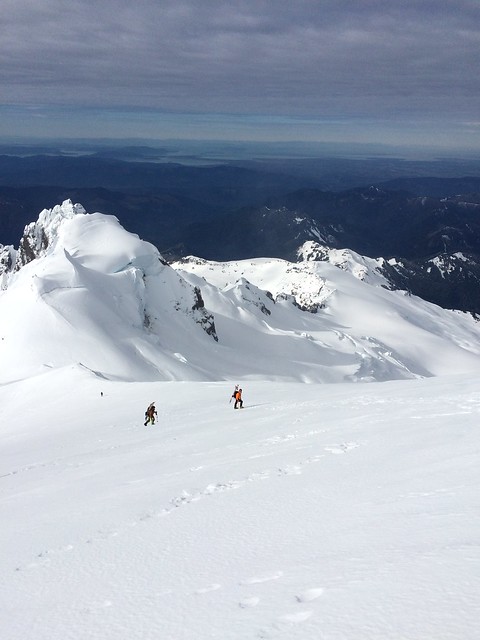
The skin up to Mazama Ridge was firm but easy, and we made great time up to Cowlitz Rocks, arriving around 10:15. After a quick transition we were skiing down the already very soft snow towards the toes of the Whitman. We contoured across the moraine at around 6300 ft and we easily found steep but straightforward gullies to ascend. Elliott was leading this section and made the decision that switchbacks were lame, so I got to use the highest risers on my bindings for more time than I have during the rest of the season combined. Around 12:00, we crested a small moraine and stood at the base of the expansive Whitman Glacier with a clear view of Little T and Big T.

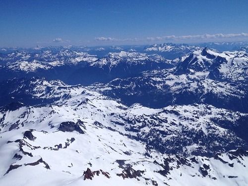
The view from Cowlitz Rocks saddle. Cathedral rock in the foreground, Little T in the back.

The view of Cathedral Rocks during the crossing of the Cowlitz Glacier.

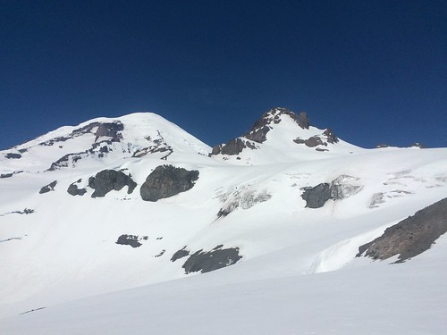
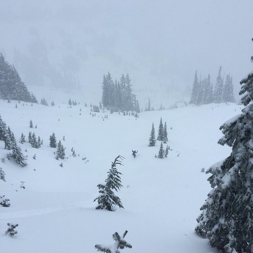
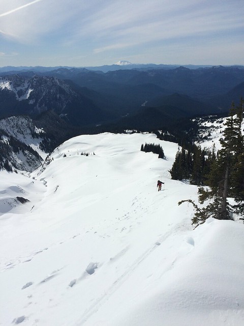
Looking up the Whitman Glacier. The route goes out of picture to the right and ascends the large snowfield on Little Tahoma.

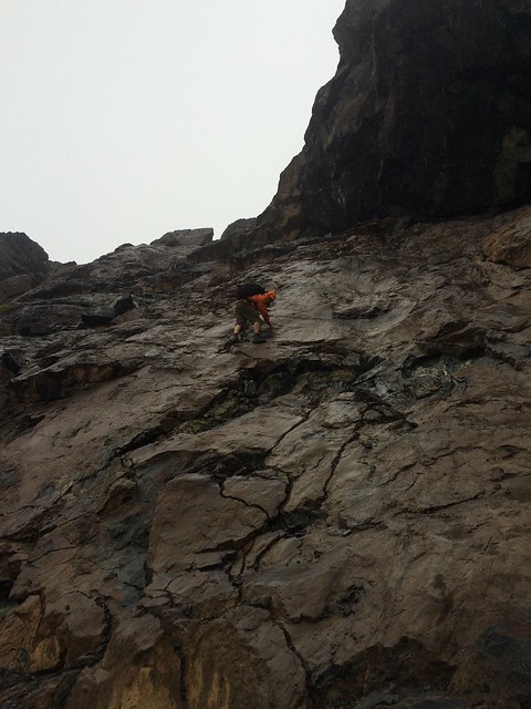
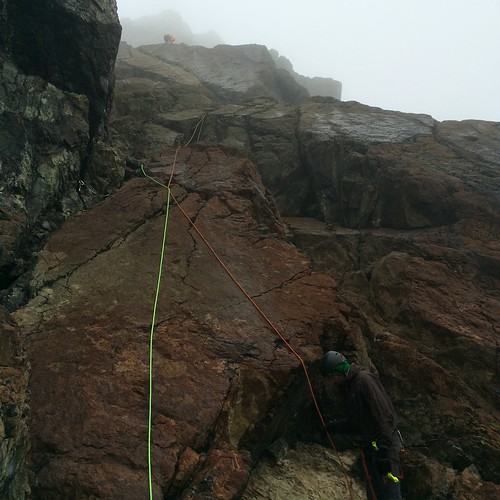
The next 1500 ft section was one of the more enjoyable stretches of skinning I’ve ever had. Easy rolling terrain, incredible views, and a light breeze to keep you just cool enough made a great combination. Soon enough we were at the base of the steep headwall of the Whitman. We skinned as high as we could, up to about 10,600 ft, and then booted up to about 10,800 where we stashed our skis and some extra gear. Another 100 ft of booting led to a short rock step with one tricky move, although trying to avoid kicking rocks down on your partners makes even the simple moves tricky. One more short section of snow led to fun, albeit rotten, rock scrambling up the summit ridge. The first view over to the North side of the ridge will certainly get your attention – both for its beauty and exposure. Once on the ridge, a short (~25 feet) traverse got us to the true summit block a little before 4:00. While the scrambling up to the ridge and the traverse to the true summit are exhilarating, Andrew and I both felt comfortable climbing and down-climbing in ski boots.

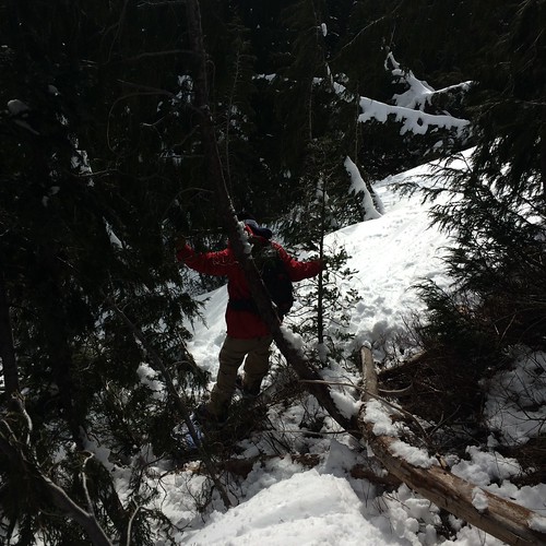
Our last bit of skinning before switching to booting.

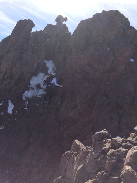
Andrew downclimbing the traverse to the summit block. Another party chose to rap down to the snowfield rather than downclimb. The timing was the same either way.
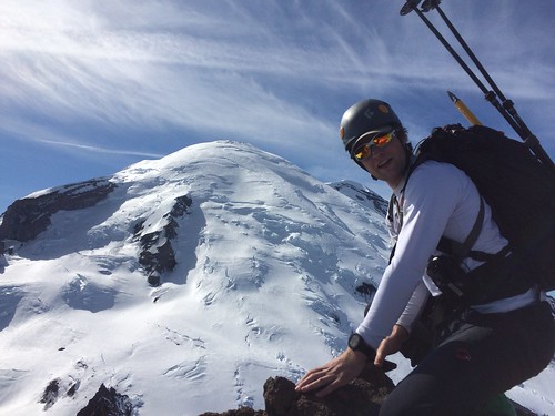
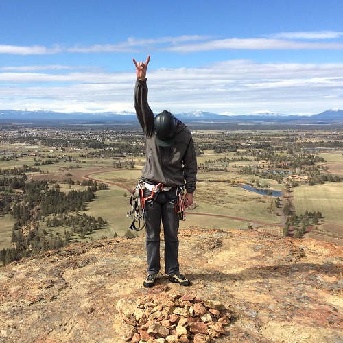
Andrew on the top.

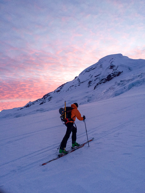
All that was left was a short boot down to our skis, 4300 feet of incredible corn skiing, 900 ft of skinning back to the Cowlitz Rocks saddle, and a leg-piercing descent/traverse to Golden Gate by 6:30. This tour makes for a long day but the scenery and fun scrambling at the top are definitely worth the effort.

Andrew and Mt. Adams after the incredible corn skiing.

GPS link with cool map feature Andrew made:

https://powersa.cartodb.com/viz/fe564d02-05dc-11e6-88d2-0ea31932ec1d/public_map


Categories
Climbing

Smith Rock, Pioneer Route

Last week I was able to get out of the rain for a two day trip to Smith Rock. The weather was perfect – low 50s and sunny during the day – also known as sending temps, bro. After a long winter of climbing plastic in the gym, our first day involved Keith and I getting reacquainted with climbing real rock. We jumped on a few moderate routes, mostly 5.8s and 5.9s. We were even able to snag an ascent of five gallon buckets without waiting in line!

We got up early the next day to try and beat the crowds up the Pioneer Route on the Monkey Face. As we approached we saw a pair of climbers cruising up the bolt ladder – but nobody else. Little did we know, those two were guides that were setting up a Tyrolean into the Monkey’s mouth for 27 clients.

Smith Rock 3/23/16

A busy day on the Monkey Face. You can barely see the tyrolean in the upper left.

The guidebook gives a good description of the route but it involves an easy (5.5) trad pitch up to a ledge with multiple bolted anchors. This puts you directly below a line of about 20 bolts that Keith aided up and I got my first experience jumaring behind him. Once into the mouth, we were able to climb the top pitch in between clients coming through. This pitch is definitely the money pitch, with steep, juggy, and crazy exposed 5.7 climbing. After taking in the views of the central Oregon volcanoes we used the guided parties’ rap line for the free hanging rappel. 2.5 hours after we started we got back to the packs and enjoyed a sandwich. We climbed a couple of cool-down sport pitches on the way back to the car and went back to the rain in Portland.

Keith following the first pitch of the Pioneer Route.

Smith Rock 3/23/16

Sam’s summit pose on top of the Monkey Face

Categories
Touring Mt. Rainier

Edith Creek, Mt. Rainier National Park

Peaker Tim and I met in Ashford and headed up to Paradise for our powder meeting. With more than a foot of fresh snow forecasted, I was skeptical that the plowers would have the gate open on time so we opted for a lazy start time. Arriving to Paradise at 10am, we were surprised (and psyched) to only see about 15 other cars.

From paradise we set out on the trail staying east of Alta Vista and eventually made our way to a place on Mazama Ridge that is labeled “Golden Gate” on the map. That label seemed a little out of place as we made our way up to the ridge. We were setting off small wind slabs and getting pounded with wind and snow. As long as we stayed off the wind loaded side of things the stability was good and the snow was even better – we’re definitely not in early season up high anymore. So, we skied down to ~5500 ft, took another lap, then went back to the car to dry. All in all a great day to welcome winter back!

IMG_2075

Tim womping


IMG_2077

Tim does the split board side step

Categories
Climbing Touring Central Cascades

Ingalls Peak, South Ridge

Hungry for some rock pitches, Tim, Andrew, and I set out for Ingalls Peak on Saturday 7/25. We weren’t going to let a 70% chance of rain/snow and 30 mph winds slow us down!

The approach follows the very pleasant trail towards Long’s Pass before heading West, up and over Ingalls Pass. None of us had been to Lake Ingalls before so we were all excited about the new terrain. It sure felt like a beautiful place from the few glimpses we got, but we mostly were looking at clouds. In fact, the entire Ingalls group was masked in clouds, so we had one false start and headed up a boulder field towards the wrong notch on the ridgeline. We soon realized our mistake and had a mini adventure finding our way to the start of the climb.

Route finding

In typical fashion, the rain picked up as we arrived at the base of the first pitch. Finding shelter under a small overhang we racked up and soon Andrew was plugging his way up the fun, gigantic cracks that comprise the first pitch. Tim and I were basking in our wind protected belay stance but could hear the howling up above. Andrew brought us up to the first ledge and the shivering commenced.

The first pitch…with extra rope drag!

The second pitch was a short one to the base of the final slab, which has a beautiful, easy crack up the middle. Well, it was actually nasty and wet and felt pretty hard, but in our sunny imaginations the rock  was great and the climbing easy. On top we took in the clouds for about 2 minutes, snapped some photos, and got out of there. Two double rope rappels got us down. A couple nips of whiskey and an hour and a half of hiking got us to the car, right in time for the sun to start shining.


Andrew on the final slab
Andrew on the final slab.
Timbo summit shot
Timbo summit shot.
Andrew rapping
Andrew rapping.
Another great day in the mountains!
Categories
Touring Mt. Rainier

Van Trump Park, Mt. Rainier

King Peaker David and I set out for Rainier with the intention of trying to find some relative solitude away from Paradise. We tossed around the idea of Pyramid Peak but premonitions of bushwhacking and being lost pointed us towards a clearer objective – Van Trump Park.

We followed the trail along the smooth granite (?) walls of Van Trump Creek past Comet Falls. Just under an hour of hiking brought us to continuous, soft snow and we started following a skin track up to the park. The recent snow was a welcome sight, although it made for tricky skinning conditions getting up to the park. Underneath the recent ~4″ was a firm crust that enabled the top layer to slab off easily but with no propagation. Once up to the mellow angles above treeline skinning conditions improved and we headed up the mellow, rolling ridge that divides the Van Trump and Kautz Creeks.

IMG_4463

IMG_4475

IMG_4480

Without a real destination we decided to stop at a flat spot around 8,000 ft with some of those fine rock seats that the volcanoes offer. After taking in the view, a beer, and some pizza we transitioned and started down. For the most part we just retraced our skin track, ducking down either side of our ascent ridge to try and find the best sliding surface. We encountered many different types of snow during the descent – pockets of wind-deposited pow on leeward aspects, hot pow on sunny aspects, icy spots on ridges, and finally grabby pow down low. I carried my skis once (David rode) and we were back at the shoes and began the hike out. 45 minutes of walking and a Rainier tall boy later we drove past the gate with almost an hour to spare.

Categories
Mt. Baker Touring

Coleman-Deming, Mt. Baker

Some of the peakers climbed Mt. Baker via the CD last weekend. We opted to skip any attempts at trailhead napping and decided to leave Seattle at midnight on Sunday morning. Fueled by the finest donuts in the 2 AM selection from Safeway, we pulled in to the trailhead around 2:45 and were walking by 3:30.

The trail is snow free up to 5,000 ft, where we ditched our shoes and put our skis where they belong, on the snow. We followed a faint skin track up the gully and to the ridge. Switch-backing up the first headwall proved tricky for those of us without ski crampons (everyone but me) but a breeze with them.

IMG_9586

As we cruised along the Black Buttes the wind started to pick up. The small amount of fresh snow from the past couple days was getting blown around with great enthusiasm and was giving our faces a nice scrub. At this point I joined the ski carrying club and we started booting up Pumice Ridge.

Although less windy than the col, any loose snow from the ridge had been blown off and what was left behind was balls of blue ice embedded in super firm sastrugi. The Roman Wall was more of the same, but steeper. Nonetheless we carried our skis up and had a good feet-numbing and ear-piercing descent. Below the col wasn’t much better with patches wind blown snow on top of ice. We got back to our shoes by 2:30 and got back to the softest ground we had all day – the trail out. We were at the car by 3:15, just short of 12 hours, what a day.

Categories
Mt. Baker

Easton Glacier, Mt. Baker

June 21-22, 2014

 After getting off-route 2 weeks prior, fellow peakers Andrew, David, Whitney and I gave the Easton Glacier another shot on a beautiful June weekend this summer. Choosing a two-day itinerary, we left seattle around 9 am on June 21. We arrived to an overflowing parking lot and found a spot on the side of the road.  After stashing our beers in some snow and deliberating over whether to bring approach shoes we got moving by noon (no approach shoes). Folflowing the trail up to Sulfur Creek it became clear shoes would have been worth the weight.

Sandy Creek

After jumping across boulder fields and a couple hopeful transitions along the creek, we finally found continuous snow in the gully below the Railroad Grade. The gully looked easy and the railroad looked dry, so we wound our way up the next 1600 feet. An hour later we crossed our first crack and started traversing west to find a camp on the shoulder. Heading straight up (due north) the rolling ridge we cruised past camp sandy and found a shelf with ridiculous views down onto the toe of the Deming glacier and the east side of Colfax. We melted water, ate some macaroni, drank some whiskey, and set the rope up for the morning.

 We woke just in time for the sunrise and started spiking up the short headwall above our camp by 5:30. The route was straight-forward, we followed the obvious bootpack up and were able to skin the first 2,000 feet (following the immediate headwall out of camp). In hindsight, we may have left too early and ran into several short, steep sections that required spikes with the hard snow. The crater rim offered a nice lunch spot and sulphur bath before we booted up the Roman Wall.

IMG_0154

The view and weather from the summit were all time. We could see down to Mexico and you couldn’t have flown a kite if you had one. I think we even took layers off at the summit. The Watson traverse looked especially appealing from this angle, so we put it on our list for next year.

IMG_2726

After lounging for an hour waiting for the snow to soften we finally clicked/strapped in around 10:00 am. The Roman Wall was a little firm but below that the skiing was 5-star, A-plus spring corn. We arrived to camp about 20 minutes after leaving the summit and the snow was already rotting below 7,000 feet. About 2 hours of heavy-pack, heavy-snow, boulder-hopping and trail walking we were back at the car drinking a beer.

david-easton-glacier