Categories
North Cascades Climbing

North Face of Burgundy Spire, Washington Pass

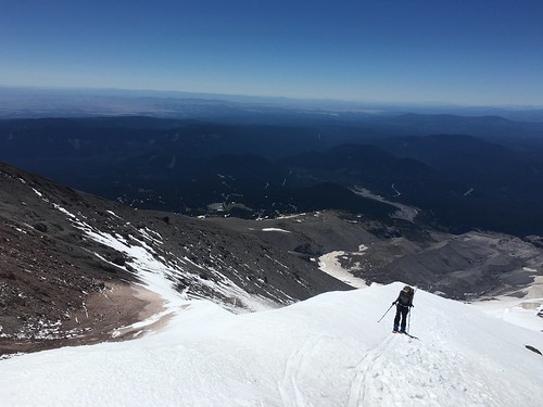
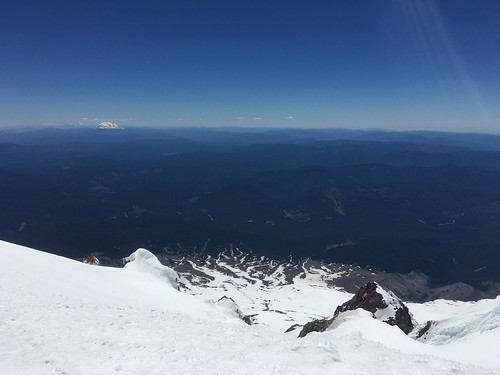
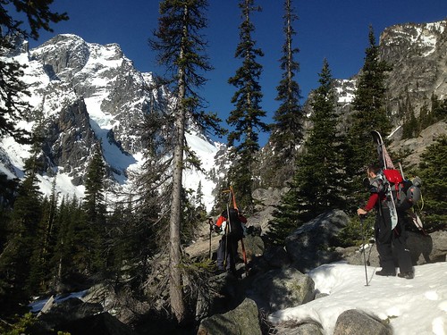
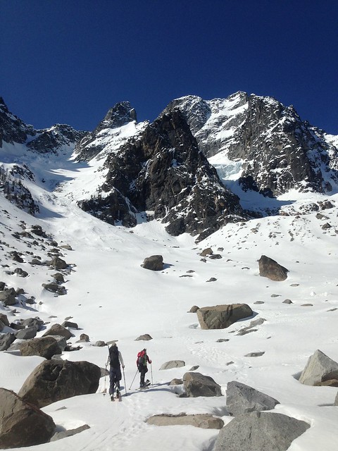
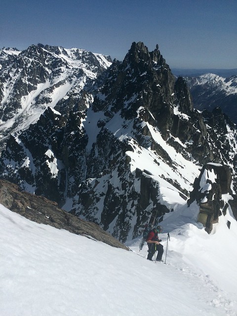
The plan was do to a Paisano Burgundy link up, but nothing that day quite went according to plan. Andrew, Tim, James and I slept at the trailhead 4mi east of WA pass, and were walking by 5:45 Saturday morning. The trail starts by scrambling down past cairns to Early Winters Creek, then weaving up through the woods to the bivy camp. The camp is roomy and has excellent views of the Liberty Bell group – next time I’ll block a few more days and plan to stay here. The trail up the spires is steep, and at times the footing is poor on marbly rocks. It is relatively easy to follow with regular cairns.

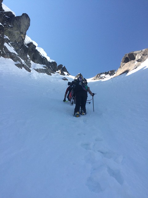
As we approached the base of Paisano around 8, it became clear that we would have to wait for a few other parties to climb before our two parties of two could jump on. Weighing our priorities for the day and recognizing that a delay may mean we couldn’t complete the link up, we decided to push on to Burgundy. We scrambled up to Burgundy Col at 7720’, roughly 3600’ above Early Winters Creek.

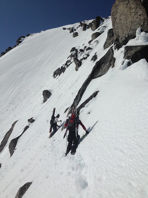
At the col we left our bags, and started scrambling to the base of the climb. We had planned on climbing the original route that heads directly up the north face of the spire. However we struggled significantly with route finding, and ultimately opted for what now seems to be the most popular route. This option traverses right at the top of pitch two. If I described the climb how we did it, it would be a messy and confusing string of climbing, rappelling, traversing, and so on. I will instead pitch it out how I would climb the North Face of Burgundy if I were to do it again.

P1. After scrambling slightly right and up from the col, rope up where the 5th class climbing starts about 45m above the col. Climb the right facing corner on the left side of the amphitheater without swinging around to the east side. Chossy rock. 5.7

P2. Trend back right to find a crack system with numerous flakes, ending on a large ledge. 5.8

Traverse right 50m, under a large block, to a long ledge to start the third pitch.

Belay ledge for P3

P3. Easy climbing in a left facing corner, then swing right, setting up an anchor roughly 25m above the last belay. 5.5


P4. Follow a fun corner hand crack with good pro, sling a horn and belay from a small stance at 30m. 5.8

Belay stance at top of P4

P5. Trend left, stepping around a bulge into a tapering left facing crack. A move or two of offwidth then good hands higher up, and a slightly overhanging jug to pull onto the ridge. Belay from the ridge to avoid rope drag, then scramble left to the summit.

Summit ridge

Descent: Two 60m ropes made for a relatively quick decent. We doubled up to rappel climbers left of our route to the next station. Another single rappel brought us to the ledge at the bottom of the third pitch. Rather than following our ascent path, we cut left down to a rappel station just after walking back under the large block. Three more double rappels brought us back to the col.

Categories
North Cascades Climbing

Southwest Rib w variation, South Early Winters Spire

Tim and Andrew beat us to the same summit up the same route two days earlier, so David and I rolled into Monday with some helpful beta for the climb. In hopes of a warmer climb we opted for a later start, leaving from the trailhead at 7am. We followed the Blue Lake trail for 1.5mi, until the terrain opened up and we had views of the Liberty Bell group. From there we took the obvious climbers trail that branched left, headed up towards Concord tower. The trail dwindled, and we got off track trending too far left, getting almost to the base of Concord before cutting back right. A high traverse across snow brought us to the base of South Early Winters Spire.

There were two parties ahead of us, so we waited at the high ponderosa hoping the sun would come over the ridge soon. When the route cleared, we scrambled climber’s left to rack up at the Y-shaped larch.

Looking back up at the approach at the end of the day

P1. The crux pitch starts mellow, then has a few 5.8 moves to get past a bulge. Protects well. 5.8

P2. The Wavy Crack – quick climbing up onto a ledge, then follows a wide left facing crack. 5.8

P3. We opted for the 10.b variation, traversing right 20m to a left facing corner. The seam starts as tight fingers, then widens slightly toward the top of the corner. The climbing gets easier further into the pitch, but has some boulder moves higher up to get over a bulge. Once over the bulge, you’re on the Nervous Nelly pitch and can look up to Bear Hug. Climb through Nervous Nelly to the ledge below the Hug. 5.10b

P4. The Bear Hug – The hug itself is only about 5m of super fun climbing. Protection felt adequate with one 4 at the bottom, but the crack would have taken a 5 and a 6 higher up. From there traverse right to a large south facing corner ledge. 5.7

P5. Easy but exposed climbing on an arête, minimal pro. Stay on the right side of the arête to find a small belay stance before the base of the gully. 5.6

David belaying from the bottom of pitch 6

P6. Low 5th class, drop down and right into the sandy gully before the ridge steepens and would require a rap to get into the gully. Belay off a tree in the middle of the gully. 5.2


P7. From the notch at the top of the gully climb the obvious crack system right to the summit. 5.6

Summit photo for mom

Descent: Down the South Arête. At the top trend left to avoid dropping down the gully. There is a tight gently sloping chimney to descend, this awkward move is somewhat easier without a pack or rope on your back. Continue down the arêtes to the first of three rappel stations. After these rappels you are at the base of South Arête, and can walk back to the base of the Southwest Rib.

Categories
Mt Hood Touring

Mt. Hood, Old Chute

Despite the unbeatable weather, when we pulled into Timberline Sunday morning the stoke level was at an unusual low. We were both feeling the effects of a short night, and pulling our packs out of the car brought the unfortunate realization that we only had one pair of crampons between the two of us. This was especially disappointing as we had tried unsuccessfully to summit this mountain multiple times, and were now determined to finally get to the top. So, as Beyoncé would do, we made our lemons into lemonade. We hoped that the warm weather and softening snow would make crampons more of a bonus than a necessity. We thought at least we could start moving up, and see how far we could get.

The first 2700’ up the south side route run just climbers right of the Palmer chair, which this time of year is shuttling paying skiers most of the way up the mountain. Skinning this stretch can be a bit of a slog, but we found a good rhythm and enjoyed watching racers bash gates as they cruised down the slope. We made respectable time to the top of Palmer, and stopped for lunch about 3000’ above the car. At this point the grade started to steepen, but the snow was soft in the 80+ degree weather and this made for smooth progress.

At a little over 9000’ we found ourselves on the wrong side of narrow stretch of rocks running the fall line. We took off our skis and scrambled left back to the snow, where we had a mostly clear view of the path to the summit. Crater Rock lay another 1000’ above us, and from there you could follow the boot pack straight up through the Pearly Gates or left towards Old Chute. Steel Cliffs loomed tall and sheer to the right. Directly ahead of us Devil’s Kitchen was a jagged cliff band covered in snow and rime, jetting up into up into the cloudless sky. As the temperature rose, we heard frequent ice and rock fall tumbling from these cliffs.

IMG_2462

From there we could see that the grade would soon prohibit skinning. We strapped our skis to our packs, and I put on Sam’s crampons. The thinking was that Sam would get more purchase on the footholds in his ski boots than I would in my snowboard boots, and therefore that I should have the spikes. We started gaining ground quickly, and as hoped he was plenty comfortable without extra traction. By the time we gained Crater Rock we had multiple incentives to keep moving. The steam from the fumaroles was so thick with sulfur it was uncomfortable to breathe, and the warming temperatures meant increasing rock and ice fall from the upper cliffs. We angled left towards Old Chute due to its more modest grade, and put all our energy into punching through that channel as quickly as possible.

IMG_2473

IMG_2477

At the top of Old Chute we came up the south side of a knife-edge. Peering over this ridge I saw that the north face of the mountain fell away below me, and Rainier, Adams, and St. Helens appeared in the distance. We carefully followed the ridge right to the summit. Although it was relatively warm from the constant sun, the wind was whipping on the summit and we were happy to add a few layers. Once we were more bundled we could better take in the view – in addition to the Washington volcanoes we had stunning views of Jefferson, the Sisters, and the Columbia River Gorge.

For the descent we walked back along the ridge line to the top of Old Chute, and strapped in there. The very top of the chute was steep and slick, and I was glad to have my ice axe in hand. About 200’ below the ridge it opened up into cirque with soft corn and smooth turns. It had been four months since I had ridden due to a broken foot, and I was thrilled to be back on the board. The descent was quick, and the snow made for fun riding down to the top of Palmer. At that point the lift had closed, and we had the runs to ourselves. The snow was stickier that far down, but skied out enough that we weren’t lurching out of our boots. At the bottom we followed the last thin track of dirty snow all the way to the parking lot. It’s always great to finally bag a summit that has skunked you a few times, and the lemonade that day was especially sweet.

IMG_2498

Categories
Central Cascades

Mt. Stuart, Sherpa Glacier

The day started dark and early, leaving Seattle just after 2am and heading toward Leavenworth. Sam, Tim, and I got to the Stuart Lake trailhead around 4:30, and we were hiking by headlamp at 5. The first four miles went quickly on the Stuart Lake trail, and we watched the Stuart range turn pink as the sun came up. Shortly after passing the junction between Stuart Creek and Mountaineer Creek, at the trail’s first switchback, we cut left off the trail. The hope was to cross Stuart Creek at a point where we could jump on the climber’s path heading toward Sherpa glacier. However we kept hiking due west along the north side of the creek, and by the time we finally crossed the creek we were past the climbers trail.

IMG_3598

The next two hours involved quite a bit of bush whacking, and limited time on the climber’s trail. We would occasionally find it, but then lose it again in the downed trees and patchy snow. At times we could peek through the trees to get views of Dragontail, Colchuck, and Argonaut peaks. By trending west we picked up the climber’s path just after a boulder field, and found ourselves at the foot of Sherpa glacier.

Stuart

Until this point we hiked the whole way with skis on our backs, and here we finally stopped to switch over to ski and skins. After 4.5 hours of carrying gear over shoddy terrain, it felt great to finally be moving on snow with light packs. Unfortunately, that wouldn’t last for long. After about 600 feet the grade steepened considerably, requiring crampons and axes. The skis went back on our packs, and we started kicking steps up the glacier.

At first the steps were easy to kick, and we made decent time switching off the lead. However just below the couloir the snow got deep and our pace slowed. At times there was about an inch of icy crust on top of 18 inches of new snow – that along with the steep grade made for very slow progress. However, Tim was indefatigable setting the boot pack on that stretch, and we steadily gained the couloir.

We reached the 8400’ col below Sherpa Peak at 2pm, later than expected due to slow moving through the couloir. From there the views were stunning – to the south Rainier, St Helens, and Adams were in sight, and peeking back over the north ridge revealed Glacier, Baker, and the North Cascades. There we stopped for a quick bite to eat before pushing west toward the summit. The first stretch was mostly traversing, and then we took a sharp angle and booted straight up to the false summit. Progressing past the false summit, we became increasingly worried about loose wet slides. The south aspect was getting baked in the warm weather, and most steps sent little slides down the face of the peak. Looking up toward the summit, we couldn’t quite find a safe angle for the approach, and we were concerned about getting off the top safely. With less than 100 ft to go, we made the difficult call to turn around.

Turn around point... <100 ft to go

We dropped back to the false summit in crampons, and then took a break to switch over to ski gear. From there we entered the top of Cascadian Couloir, but skied very cautiously due to the significant wet slides we were releasing with every turn. Finally we dropped back into the couloir above Sherpa glacier. The top of the couloir yielded the exact opposite conditions – cold and icy. However, as we approached the middle of the glacier the snow turned softer, and we ended the descent with some great turns.

Once off the snow we followed the climber’s trail for about a mile, before losing it in the brush. The next two hours involved bush wacking along Mountaineer Creek, until we finally charged north across a marsh and ended back up on the Stuart Lake trail. We got back to the car around 9, making for a 16 hour trip. Burgers and beers at the Bavarian Bistro in Leavenworth gave us just the fuel we needed for the drive back to Seattle.

IMG_3631