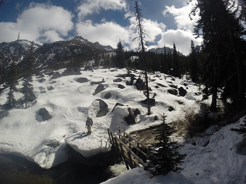
The day started dark and early, leaving Seattle just after 2am and heading toward Leavenworth. Sam, Tim, and I got to the Stuart Lake trailhead around 4:30, and we were hiking by headlamp at 5. The first four miles went quickly on the Stuart Lake trail, and we watched the Stuart range turn pink as the sun came up. Shortly after passing the junction between Stuart Creek and Mountaineer Creek, at the trail’s first switchback, we cut left off the trail. The hope was to cross Stuart Creek at a point where we could jump on the climber’s path heading toward Sherpa glacier. However we kept hiking due west along the north side of the creek, and by the time we finally crossed the creek we were past the climbers trail.
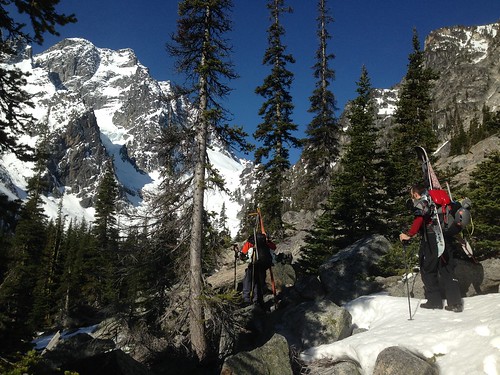
The next two hours involved quite a bit of bush whacking, and limited time on the climber’s trail. We would occasionally find it, but then lose it again in the downed trees and patchy snow. At times we could peek through the trees to get views of Dragontail, Colchuck, and Argonaut peaks. By trending west we picked up the climber’s path just after a boulder field, and found ourselves at the foot of Sherpa glacier.
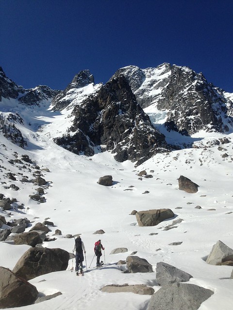
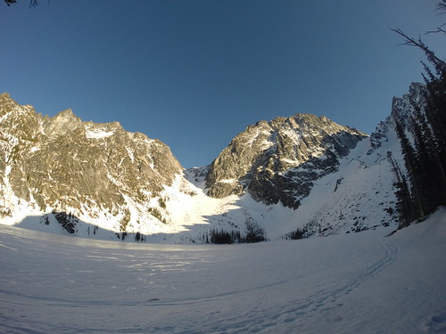
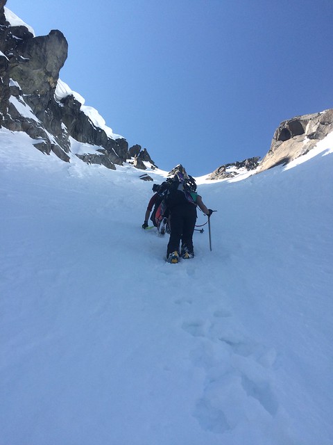
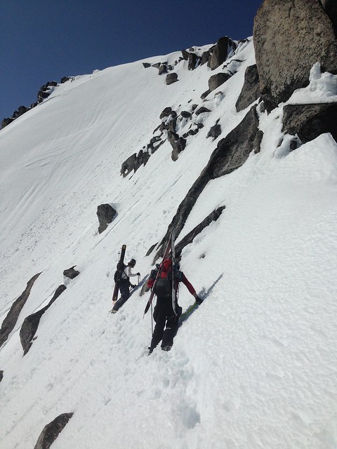
Until this point we hiked the whole way with skis on our backs, and here we finally stopped to switch over to ski and skins. After 4.5 hours of carrying gear over shoddy terrain, it felt great to finally be moving on snow with light packs. Unfortunately, that wouldn’t last for long. After about 600 feet the grade steepened considerably, requiring crampons and axes. The skis went back on our packs, and we started kicking steps up the glacier.
At first the steps were easy to kick, and we made decent time switching off the lead. However just below the couloir the snow got deep and our pace slowed. At times there was about an inch of icy crust on top of 18 inches of new snow – that along with the steep grade made for very slow progress. However, Tim was indefatigable setting the boot pack on that stretch, and we steadily gained the couloir.
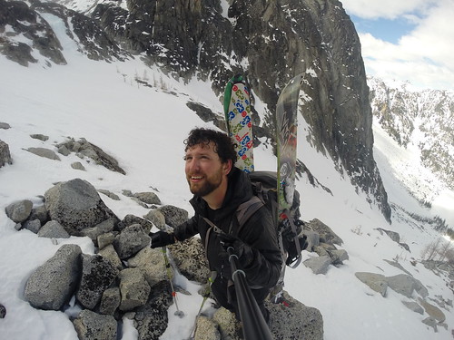
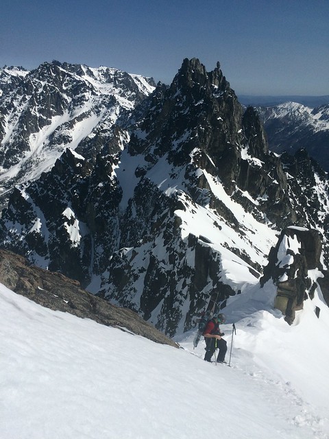
We reached the 8400’ col below Sherpa Peak at 2pm, later than expected due to slow moving through the couloir. From there the views were stunning – to the south Rainier, St Helens, and Adams were in sight, and peeking back over the north ridge revealed Glacier, Baker, and the North Cascades. There we stopped for a quick bite to eat before pushing west toward the summit. The first stretch was mostly traversing, and then we took a sharp angle and booted straight up to the false summit. Progressing past the false summit, we became increasingly worried about loose wet slides. The south aspect was getting baked in the warm weather, and most steps sent little slides down the face of the peak. Looking up toward the summit, we couldn’t quite find a safe angle for the approach, and we were concerned about getting off the top safely. With less than 100 ft to go, we made the difficult call to turn around.
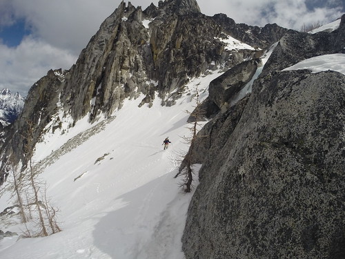
We dropped back to the false summit in crampons, and then took a break to switch over to ski gear. From there we entered the top of Cascadian Couloir, but skied very cautiously due to the significant wet slides we were releasing with every turn. Finally we dropped back into the couloir above Sherpa glacier. The top of the couloir yielded the exact opposite conditions – cold and icy. However, as we approached the middle of the glacier the snow turned softer, and we ended the descent with some great turns.
Once off the snow we followed the climber’s trail for about a mile, before losing it in the brush. The next two hours involved bush wacking along Mountaineer Creek, until we finally charged north across a marsh and ended back up on the Stuart Lake trail. We got back to the car around 9, making for a 16 hour trip. Burgers and beers at the Bavarian Bistro in Leavenworth gave us just the fuel we needed for the drive back to Seattle.