Categories
North Cascades Mt. Baker Touring

Mt Herman, Stoneman Couloir

Alright! Time to break the long silence with the first snowboard trip report of the season. Did you miss us?

IMG_9820

We went up Table Moutain and Herman a couple weeks ago but it didn’t quite warrant a write up. Fast forward to today and once again we were heading out of the upper lot at the resort around 9am. The snow around Bagley Lakes has been hit hard with tracks since the last storm but was holding up great with the cold temps in the last week.

We headed toward the high saddle that splits Bagley Creek from Mazama Bowl where we found deep consolidated powder on E and SE facing slopes. Dropping in off Mazama Dome we found much looser unconsolidated but mostly stable snow on N and NW aspects that made for some killer turns but difficult uphill as we transitioned and made the approach to the saddle below Herman proper.

IMG_9854

From there it was a boot pack traverse out to the top of the couloir where we made the transition at 11:30am. While we were not the first to ride Stoneman Couloir on this last storm cycle, it hardley mattered as there was plenty of room for everyone and the snow was deep and light. At the bottom we traversed left above the trees to a smaller tighter couloir that starts at about 5300ft.

IMG_9855

Now to find a way out.. From 4800ft the exit down to Bagley Creek either requires a hard cut right or a hard cut left. We tried to split the difference and ended up on a cliff band that required some trickery to get down. Next time I will opt for the honest line. In the end we made it out arriving back in the Heather Meadows parking lot a little before 2pm.

Check Stoneman off, and then add it back on the list. This one is a classic!


More photos courtesy of Corbin Hudacek here

Categories
Climbing Stevens Pass

Prusik Peak, West Ridge

The great debate, skiing vs snowboarding, Hillary vs. Trump, is OJ Simpson innocent? And then the big one; to approach Prusik Peak from Snow Lake or from Colchuck Lake. Certainly there are merits to both but in this increasingly partisan world, people have picked their approach and climbing teams all over the Northwest and beyond have been ripped apart by their inability to see the other side.

On one hand you have Colchuck Lake; less mileage and slightly less elevation but a grueling climb up Asgard Pass gaining 2200ft in less than a mile. On the other hand Snow Lake; nearly 6 miles longer but a much more gradual elevation gain, a well marked trail and significantly less snow and ice this time of year.

Fortunately Whitney and I are rarely consumed by such mindless bickering so after weighing our options carefully, I won and we went from Snow Lake.

IMG_8198

Personally, I wasn’t keen on trying to tick this one off in a day, but we didn’t like our chances for getting a permit in the Core Zone so Whitney suggested we just go for it. So we did, starting out from the trailhead at 5:15am. The spillway at Snow Lake was running about ankle high when we crossed at 8am, stopped at Lake Viviane for an early lunch and made the turn off to Prusik Pass at 11. From here the trip gets better.

IMG_8200

The snow is patchy beginning in the upper lakes becoming fairly consistant by the time you hit Perfection Lake. Trying to find the high point on Prusik Pass we lost the climbers trail in the snow and started on the route a little early. In this way we got an extra pitch in on some mossy rock that wanted climbing. No doubt we are not the first climbers to climb this desperate crack. From there the climb was as follows.

Pitch 1

The longest pitch, it ran through just about all 70 meters of the rope but its fairly soft climbing trending left until you hit the ledge.

IMG_8209

Pitch 2

This one was a quicky. You jump over to the north side and up a short slab until you hit the piton and slingable block right before the crux.

Pitch 3

The crux is really only 3 frictiony moves that feel exposed because theres nowhere to protect. Whitney clipped the piton and pulled the crux like a pull tab. From there, climb high and right traversing the south side with excellent exposure, until you hit the notch and then back over to the north side. Communication was a little tough here and rope drag was bringing us down so we stopped to belay.

IMG_2698

Pitch 4/5

From here you scoot out onto a series of wide ledges back on the north side. They can really just be done as a casual scramble to set you up at the bottom of the final pitch. This is where the climbing gets really jazzy. Climb up a dihedral on the left then move right to a big lay back flake. We skipped the obvious wide crack directly above and instead climbed right around the corner to two smaller chimneys to make the summit at 4pm.

IMG_8215

From the top it is 5 raps down the north side to the base. We traversed back around to where we stashed our gear at the start and were on our way out by 530pm.

IMG_2706

We hit Snow Lake at 8pm. Nada Lake at 830pm. Car at 1050pm. The last couple miles were dark and pretty slow. A brutally long day but an absolutely classic climb, for hotdog and hamburger lovers alike. Next time we’ll try it from Colchuck.

Categories
Mt Hood Touring

Mt. Hood, Old Chute

Despite the unbeatable weather, when we pulled into Timberline Sunday morning the stoke level was at an unusual low. We were both feeling the effects of a short night, and pulling our packs out of the car brought the unfortunate realization that we only had one pair of crampons between the two of us. This was especially disappointing as we had tried unsuccessfully to summit this mountain multiple times, and were now determined to finally get to the top. So, as Beyoncé would do, we made our lemons into lemonade. We hoped that the warm weather and softening snow would make crampons more of a bonus than a necessity. We thought at least we could start moving up, and see how far we could get.

The first 2700’ up the south side route run just climbers right of the Palmer chair, which this time of year is shuttling paying skiers most of the way up the mountain. Skinning this stretch can be a bit of a slog, but we found a good rhythm and enjoyed watching racers bash gates as they cruised down the slope. We made respectable time to the top of Palmer, and stopped for lunch about 3000’ above the car. At this point the grade started to steepen, but the snow was soft in the 80+ degree weather and this made for smooth progress.

At a little over 9000’ we found ourselves on the wrong side of narrow stretch of rocks running the fall line. We took off our skis and scrambled left back to the snow, where we had a mostly clear view of the path to the summit. Crater Rock lay another 1000’ above us, and from there you could follow the boot pack straight up through the Pearly Gates or left towards Old Chute. Steel Cliffs loomed tall and sheer to the right. Directly ahead of us Devil’s Kitchen was a jagged cliff band covered in snow and rime, jetting up into up into the cloudless sky. As the temperature rose, we heard frequent ice and rock fall tumbling from these cliffs.

IMG_2462

From there we could see that the grade would soon prohibit skinning. We strapped our skis to our packs, and I put on Sam’s crampons. The thinking was that Sam would get more purchase on the footholds in his ski boots than I would in my snowboard boots, and therefore that I should have the spikes. We started gaining ground quickly, and as hoped he was plenty comfortable without extra traction. By the time we gained Crater Rock we had multiple incentives to keep moving. The steam from the fumaroles was so thick with sulfur it was uncomfortable to breathe, and the warming temperatures meant increasing rock and ice fall from the upper cliffs. We angled left towards Old Chute due to its more modest grade, and put all our energy into punching through that channel as quickly as possible.

IMG_2473

IMG_2477

At the top of Old Chute we came up the south side of a knife-edge. Peering over this ridge I saw that the north face of the mountain fell away below me, and Rainier, Adams, and St. Helens appeared in the distance. We carefully followed the ridge right to the summit. Although it was relatively warm from the constant sun, the wind was whipping on the summit and we were happy to add a few layers. Once we were more bundled we could better take in the view – in addition to the Washington volcanoes we had stunning views of Jefferson, the Sisters, and the Columbia River Gorge.

For the descent we walked back along the ridge line to the top of Old Chute, and strapped in there. The very top of the chute was steep and slick, and I was glad to have my ice axe in hand. About 200’ below the ridge it opened up into cirque with soft corn and smooth turns. It had been four months since I had ridden due to a broken foot, and I was thrilled to be back on the board. The descent was quick, and the snow made for fun riding down to the top of Palmer. At that point the lift had closed, and we had the runs to ourselves. The snow was stickier that far down, but skied out enough that we weren’t lurching out of our boots. At the bottom we followed the last thin track of dirty snow all the way to the parking lot. It’s always great to finally bag a summit that has skunked you a few times, and the lemonade that day was especially sweet.

IMG_2498

Categories
North Cascades Climbing Touring

Mt. Shuksan, North Face

Summary

They told us the approach would be hell this late in the season. It was, but we’ll never admit it.

The Details

Car to Base of White Salmon Glacier, 4:00-7:15

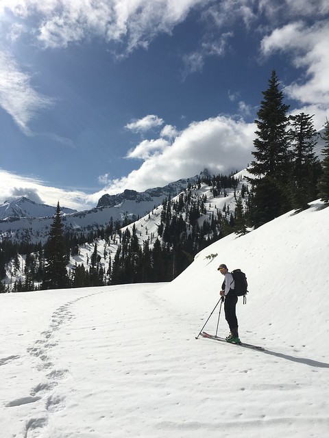
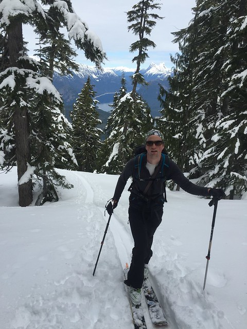
We parked at the gate to White Salmon Lodge, left the car at 4am and walked the road past the lodge to the base of Chair 8.
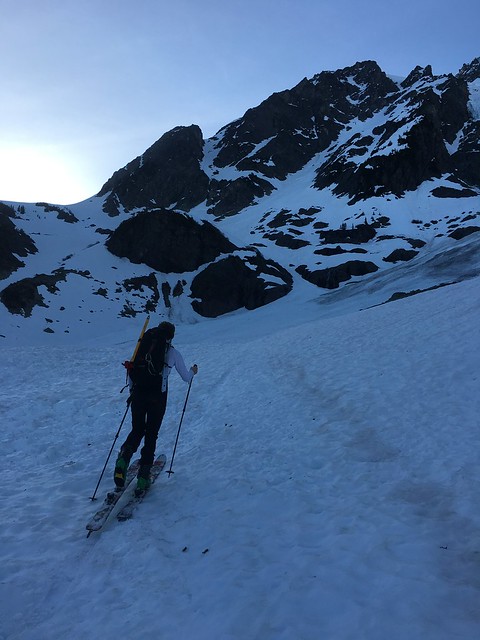
There was plenty of snow. Material online and on paper described two ways forward from here. The first has you traverse along Shuksan Arm, maintain elevation where you can and generally avoid the dense brush in the valley. The second has you drop immediately from Chair 8 through an old clear cut to the valley floor. We went with option one and found a suitable place to cross the first (of many creeks) several hundred feet upstream. In general, our route from here maintained elevation along the Arm. We did a fine job, but sloppy snow, cliff bands and creeks made progress relatively slow. This approach worked well, though would have been better with more snow. We felt smug as hell on the open slopes below Shuksan. Where was all the alder we’d been warned about? Naysayers be damned!

Open Slopes to Base of NF, 7:15-9:00

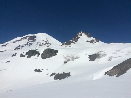
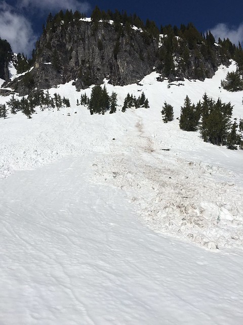
With plenty of light, and a clear view of the saddle below the NF, we picked up the pace of travel. The debris field beneath the Hanging Glacier impresses the power of the mountain upon the observer. Don’t mess around.

We trended climber’s right and wrapped up and around a large rock outcropping in the path to the saddle. In retrospect, trending climber’s left  might have been more efficient, especially with more coverage. The snow surface was variable. Frozen and hard in some places, and soft in others. Wet skins and loose corn eventually brought us to the saddle. We had a quick snack, donned harness and threw skis on our packs.

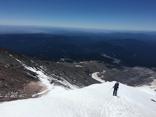
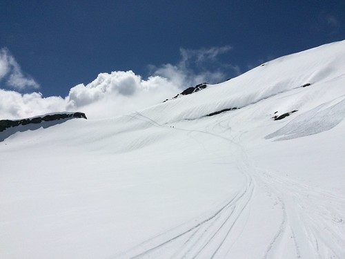
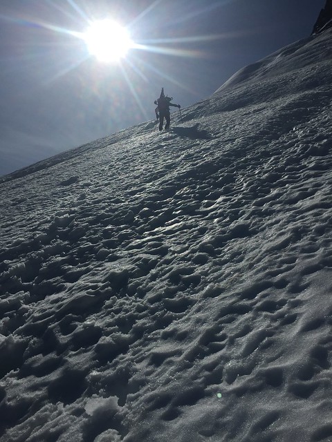
Traverse from Saddle to NF, 9:15-9:45

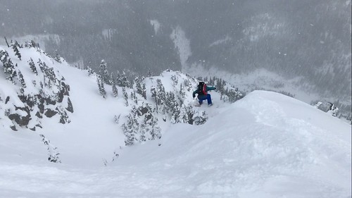
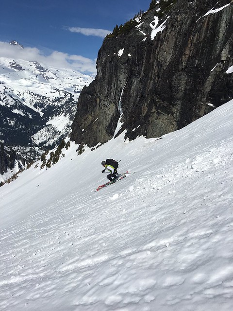
We were roughly an hour behind schedule, but decided to push out toward the face. This section has a lot of exposure. Cliffs rise to your right, and Price Lake is visible several thousand feet below. The slope isn’t that steep but it left me on edge. At this point, we were pretty concerned with the quality of the snow. It was wet and soft to a depth of 10-15 inches. Even though this section had received sun for several hours, it was clear it hadn’t frozen the night before. As boots displaced snow, we kept a very close eye on the progress of rollers down slope. They didn’t entrain other snow, generally broke up a dozen feet below us. We proceeded with caution into the hot sun.

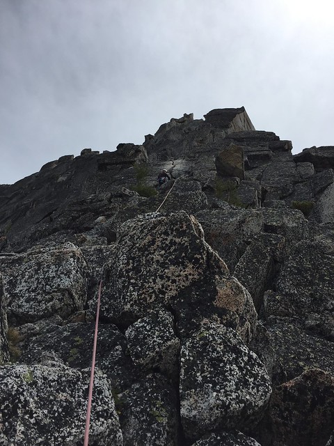
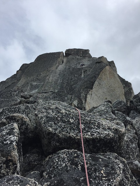
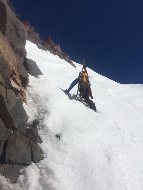
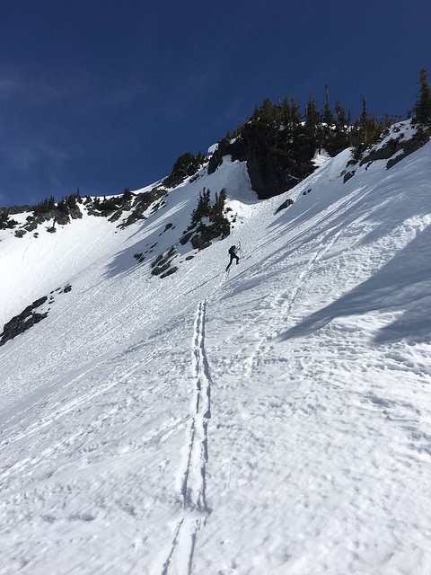
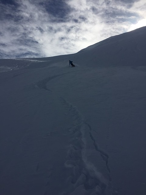
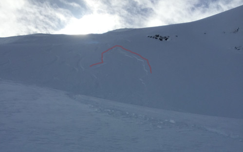
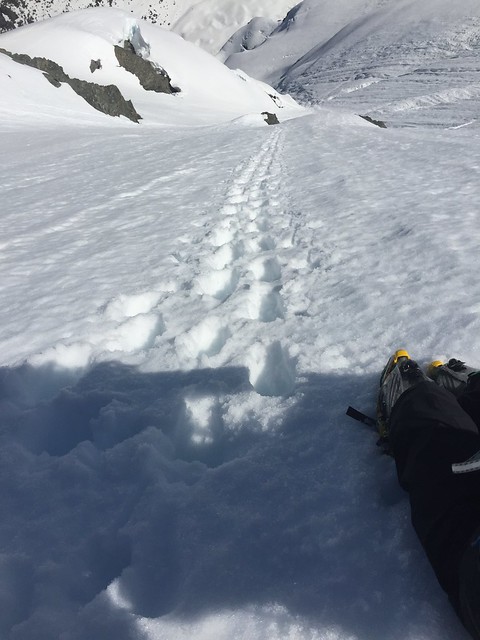
NF Ascent, 9:45-12:45

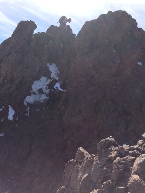
Tim and I took stock of the line, and the terrain we just crossed. We acknowledged that we didn’t want to retreat along the traverse later in the day given continued solar affects. We committed to topping out. The first 500 feet had some large cracks. We navigated them without too much trouble and avoided the main runnel that runs down the face wherever possible. One can see exposed rock above, and the lines written by releases of yesterday.

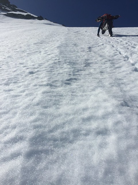
We trended climber’s right and at about 6,900 ft (10:45) passed through a notch between two rocks. At this point, exposure from cliffs above the lower face decreased. We took a deep breath and established a rhythm as snow firmness increased with elevation gain.

It’s worth noting that this section of the climb is steeper and receives less early morning sun this time of year. The breeze picked up as well. Tim set a g-o-r-geous boot pack in firm conditions on the upper face. I wished I had a second ice tool.

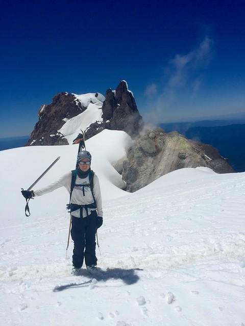
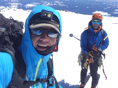
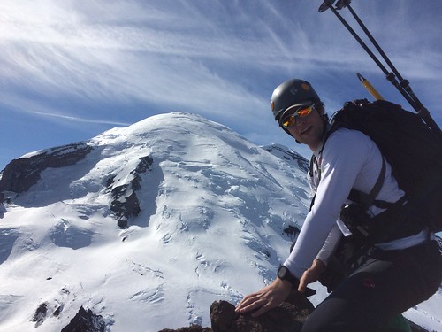
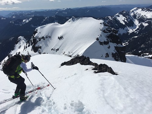
Lunch & Options, 12:45-14:00

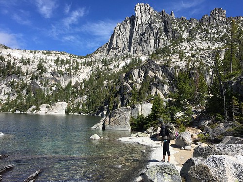
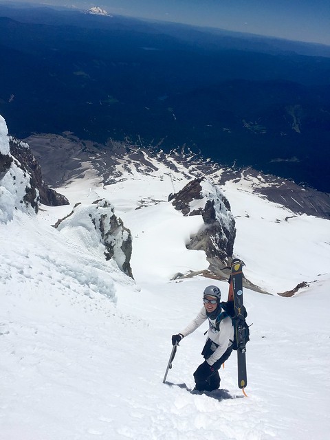
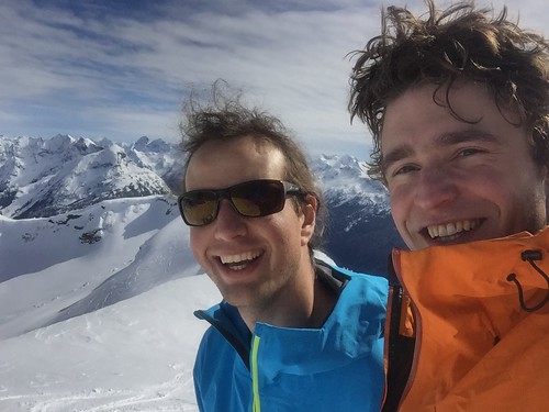
The rock that borders the top of the climb make an excellent lunch perch, with astounding views to Price Lake and the valley below… Not to mention the summit pyramid of Shuksan. When we left the car that morning, we weren’t planning to ski back down the NF. Needless to say, the climb hadn’t changed our minds. We had two (reasonable) options from here. Circumnavigate the summit pyramid (and possibly summit) or take the Hanging Glacier to the White Salmon (via the Upper Curtis). The decision was postponed until we toured up to the saddle SE of our resting place.

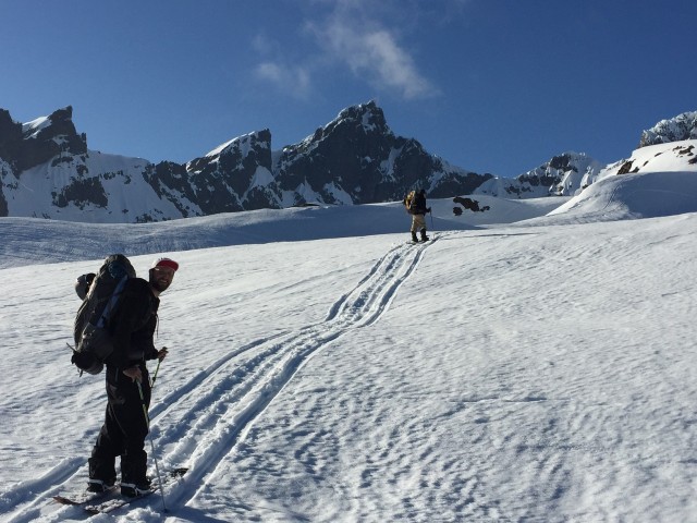
From here, we were able to see the upper reaches of the HG to our west and the Crystal to our south. A quick look at the time and the smooth corn to the west, and we made the easy decision to save the summit for another day. In retrospect, this was a fantastic choice.

Descent to End of Snow, 14:00-16:00

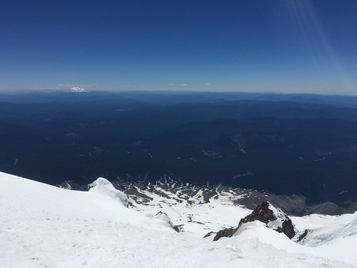
Perfect corn down the HG to the Upper Curtis. We were cautious for several reasons, the most obvious being cracks. We also didn’t want to miss the entrance to the White Salmon, somewhere to skier’s right. As we approached the ridge separating the Curtis from the White Salmon, Tim wondered if we could tour up along the Arm. Anybody know if that’s a viable route?

Our last few cuts on the Upper Curtis were a turning point in the tour. All of a sudden, loose wet became a major concern. Hot pow cut from our tracks slid slowly down the steep glacier.

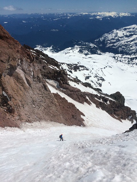
At the top of the White Salmon, the snow is less exposed to the sun. We evaluated the terrain and plotted a route down. The first 500 feet were consumed boarding fall line on quality corn. There are many roll-overs, we paused atop each to avoid boxing ourselves in.

DownSalmon

The temperature increased dramatically and snow quality suffered. The remainder of the descent was spent minimizing exposure to wet loose. We traversed left across the slope toward mellower terrain, cliffs below. Nothing major released, though some slow movers plodded away.

Some good hot turns and a few short carries took use all the way to the end of snow. Phew. As we drank the last of our water and shared a final bar, our thoughts turned to open roads and full changes…


The Alder Path, 16:00-17:15

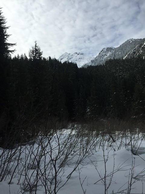
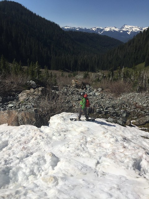
The Arm wasn’t on our list. It was hot on the way in. We knew it was a dead end on the way out. We generated a mental map of the valley, noting where we’d break up through the trees toward Chair 8. It looked close, doable in an hour.

The first 30 minutes were spent trailing creeks, reminding me why I like summer in the mountains. Then the undergrowth got thicker and thicker. In retrospect, it wasn’t too bad…

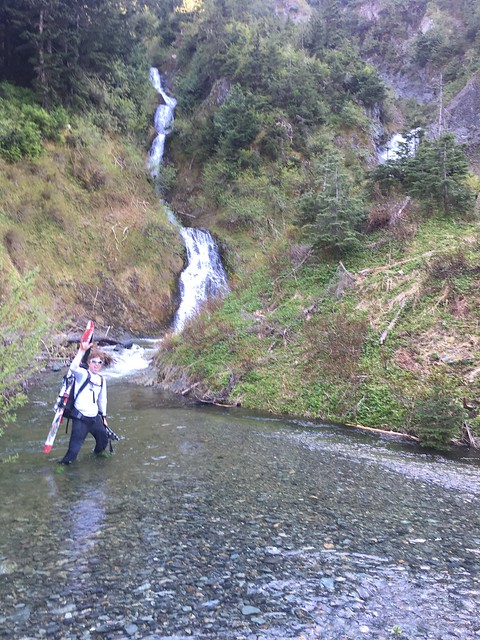
We were close, maybe 200 yards from the clear cut. The alder was thick, and we’d been up and down the creek looking for a place to cross. We back tracked to the pool below the waterfall and charged in. Drained boots on the far side, wrung out socks and swore never to admit the alder had been as bad if not worse than David claimed it would be.

We’re on it Now, 17:15-19:00

One of Tim’s many great qualities is his ability to buy in, to validate the reality and cultivate an attitude that gets you through to the other side. Coming out of the valley was tough. Tim wrestled his way up steep slopes through the trees and brush. I tagged along.

There’s not much to say about this section. Not much advice to give. I guess do it early in the season, or don’t do it at all, or just do. When we finally squeezed through the brush onto the gravel road below Chair 8, we were a thousand steps from dry feet and a big gulp of water. Amen.

Bye Bye Big Gulp, 19:00-22:45

We arrived at the car triumphant, having just passed a nice couple on their way to a sunset picnic. Bags hit the pavement, I threw my ski boots off and started digging for the vest that held my keys. When I saw all 3 zippers gaping, I knew immediately. The keys were gone. All the times I’d thrown that thing around flashed before my eyes. For all I knew, they were sitting at the top of the North Face.

Bye bye big gulp. Bye bye dry shoes. We were stuck. Eli, Tim’s brother came to the rescue. After mere seconds of pleading, he agreed to drive out to pick us up. He even grabbed a spare set of car keys from my beloved housemate, Evan.

Tim and I killed the time doing laps up to White Salmon Lodge to stay warm. We ate palm fulls of crushed ritz crackers and begged water from kind motorists. By the time Eli arrived, I was fading in and out of cold sleep on the pavement. Tim was whistling to himself, mumbling about northern lights.

Categories
Touring Mt. Rainier

Mt. Rainier, Fuhrer Finger

This one has been in the works for a month or two but this last weekend we finally got our schedules to line up with a weather window so the Fuhrer Finger was a go.

Chris and Colby drove in from Utah on Friday and camped out, so Sam and I met them in the Paradise parking lot Saturday morning around 9:00 am. We spent a couple hours arguing over gear and drinking beers at the car before finally setting out around 11:00 am. A skin up to Glacier Vista and a ski down the other side of the moraine put us on the lower Nisqually Glacier where we crossed with out roping up seeing no evidence of anything that opened yet this season. Of greater concern was rock fall and wet slides in which we saw increasingly as the temperatures climbed toward the 51° high for the day.

On the other side of the Nisqually we ascended to the Wilson Glacier up a chute know as the Fan. At this point wet slides were a real prospect and we saw several trigger as skiers rode down from their high camps. We reached the ridge at 7800 ft and followed it up to 9000 ft where we made camp for the evening around 4:30 pm.

IMG_7815

As the sun went down the wind picked up and really whipped around so by the time the alarm went off at 2:30 am it was just as well, we weren’t sleeping much anyways. From the tent we could see the headlamps of several teams making their way up the lower Wilson toward us, in what was likely a single day push for the summit. We wrestled with our gear and fought to stay warm before shouldering our boards and skis, roping up and setting off. This was pretty straight forward although there was a massive debris pile to cross and a few big cracks to side step but then we arrived at the base of the finger. There were a few teams already in it at various stages of their climbs so we unroped to travel easier, switchbacking until it was too steep and front pointing became the only option.

At the top of the finger we were almost forced to stay left onto the ridge as the upper Nisqually is so broken up at this point in the season, trying to navigate it would be a headache. The ridge is much steeper however and provides the crux of the route on both the ascent and descent, a 50°+ pitch around 12200 ft where a fall would have harmful implications.

At 13,400 ft we roped up for the final time and made our push to the summit on skins. The splitboard on the feet proved to be crucial when at 14,000 ft the snow bridge I was crossing collapsed leaving me suspended over the void with just the tip of my split hanging onto the up hill side of the crack and my tail on the other side. Good prevailed in the end though and we topped out around 1:00 pm. The weather on the summit was warm and if it hadn’t been for a strong breeze blowing around, tank tops would have been appropriate attire. As it was we were already a few hours behind our anticipated schedule so we hurried down.

nice work dudes!

The top 2000 ft of turns left much to be desired, retracing our climbing route as we rode down. Around 12400 ft the snow was beginning to warm, making the crux on the ridge just bearable (though we did see one guy down climbing it). By the time we got to the top of the finger the snow was perfect leaving us with 2500 ft of spring time riding down the Fuhrer Finger, on the tallest volcano in the lower 48.

Back at camp we packed up and headed out ready to get back to the car. We enjoyed another 1600 ft of good turning before the snow quality deteriorated completely and turned to slop. A happy first ride off the top of Rainier. Let’s not wait so long to do it again!

Photos Courtesy of: Sam Hobbs

Categories
Touring Movies Central Cascades

Cashmere Mountain, Questionmark Coilour

It was with variable spring weather in the forecast that Tim and I started game planning a Sunday tour. Originally looking at the goat rocks region, notice of a washed out road changed our plans. We started looking east and found decent weather as close by as Leavenworth. With icicle creek road bare and dry we opted for a tour off its flanks. Cashmere seemed to be a good option. We tied up the hiking boots and headed up toward Lake Victoria from FS 7605 (elev 2400′).

After getting out of the lowland brush, a sweet couloir off the north ridge of Cashmere mountain presented itself. It seemed complicated though. Aside from questions of whether the thing even got us off the rock face, Victoria Creek had started roaring with the snow melt and would possibly separate us from being able to get back to the trail.


Tim eyes up the couloir to the left, Johnny V scouts the trail


Another angle on the couloir

We kept booting until we hit a reasonable snowpack at 4700′ and tossed the hiking boots for the snowboard boots. Skinning was challenging at parts with a lot of melted out terrain. In hindsight, skinning would have started around 5000′. Scratch that, in hindsight we would have brought our downhill boards. We booted more that 75% of this thing.


Definitely patchy in places

Eventually we hit the creek crossing with substantial snow bridges. Not long after we arrived at the lake. A couple of our friends were snow shoeing with us with plans to chill at the lake eventually meetig us at the car. We had become confident enough in the couloir route so we headed left at the lake and on up. Straight up.

Snow conditions made skinning incredibly difficult so we booted up to a ridge. At this point we noticed the weather coming in from the west. Things would be questionable without visibility. We picked up the pace and topped out at 7100′ just as it started snowing. The sun was still shining though, and we could see the very broad entrance of a couloir. It seemed like it went, but it looked much broader than the one we were after.

With time running out, we boarded up and got ready for our decent. We started down a ridge and I went skiers right to see if I could find the coulior we were after. Nothing that direction. We then debated dropping into the large coulior. After a bit of discussion we realized this had to be it. After booting back up a little to the entrance it was go time. Once we dropped in it was apparent we were in the right place.

The snow was very firm once inside. Lot of chatter on the way down until we found some sun ripened corn. Super mixed conditions all the way down but what a blast. It was steep and adventurous. At one point there was a 30 foot cliff where the snow had separated from the rock forming a schrund. The gap was jumpable but not by much. The rest of the way down was fun, but that’s when the real fun started – find the exit!

Quick edit of the decent:

We traversed to Victoria creek which sounded rageful. Luckily for us there were plenty of downed trees that acted as sketchy bridges. The traverse to the trail was heavy with brush, lots of bushwhacking. With some hootin and hollerin we heard our friends Brandon and John in the distance. We found the “established” trail but they were still off to the left, buzzin through the brush. The trail can be hard to find at times. Eventually we all linked up giving Tim and I a chance to change out shoes. A rainbow appeared along with the drizzle of rain giving us the gamut of weather we often see in our lovely maritime ranges around this time of year. Great tour, would love to rip questionmark coulior again in the winter!

Bonus TR: RICO’S PIZZA

If you’ve ever driven westbound on highway 2 over Steven’s Pass toward Seattle you’ve seen the sign. You’ve seen the establishment, sticking out like a sore thumb. But you probably haven’t been inside. With so many friends aware of this place, having passed by hundreds of times, and not a single report of a visit to this legendary place, we had to engage our curiosity. Results – Very good pizza, definitely worth a visit.

Categories
Touring Mt. Rainier

Little Tahoma, Whitman Glacier from Paradise

With a forecast calling for an early preview of summer, Andrew, Elliott, and I decided to take advantage and ski Little Tahoma on Sunday. We made it to Paradise around 8:30, and were soon walking down to Fourth Crossing to start the tour. Unfortunately for us, I had been to Cowlitz Rocks once before and we had started at 4th crossing on that trip, so I opted to repeat that same route. It was only later that we realized how easy it would have been to skin up to Golden Gate and cross over to the Cowlitz there. Oh well, what’s an extra couple hundred feet of vert on top of the 7k+ we were planning on?


The skin up to Mazama Ridge was firm but easy, and we made great time up to Cowlitz Rocks, arriving around 10:15. After a quick transition we were skiing down the already very soft snow towards the toes of the Whitman. We contoured across the moraine at around 6300 ft and we easily found steep but straightforward gullies to ascend. Elliott was leading this section and made the decision that switchbacks were lame, so I got to use the highest risers on my bindings for more time than I have during the rest of the season combined. Around 12:00, we crested a small moraine and stood at the base of the expansive Whitman Glacier with a clear view of Little T and Big T.

The view from Cowlitz Rocks saddle. Cathedral rock in the foreground, Little T in the back.

The view of Cathedral Rocks during the crossing of the Cowlitz Glacier.

Looking up the Whitman Glacier. The route goes out of picture to the right and ascends the large snowfield on Little Tahoma.

The next 1500 ft section was one of the more enjoyable stretches of skinning I’ve ever had. Easy rolling terrain, incredible views, and a light breeze to keep you just cool enough made a great combination. Soon enough we were at the base of the steep headwall of the Whitman. We skinned as high as we could, up to about 10,600 ft, and then booted up to about 10,800 where we stashed our skis and some extra gear. Another 100 ft of booting led to a short rock step with one tricky move, although trying to avoid kicking rocks down on your partners makes even the simple moves tricky. One more short section of snow led to fun, albeit rotten, rock scrambling up the summit ridge. The first view over to the North side of the ridge will certainly get your attention – both for its beauty and exposure. Once on the ridge, a short (~25 feet) traverse got us to the true summit block a little before 4:00. While the scrambling up to the ridge and the traverse to the true summit are exhilarating, Andrew and I both felt comfortable climbing and down-climbing in ski boots.

Our last bit of skinning before switching to booting.

Andrew downclimbing the traverse to the summit block. Another party chose to rap down to the snowfield rather than downclimb. The timing was the same either way.

Andrew on the top.

All that was left was a short boot down to our skis, 4300 feet of incredible corn skiing, 900 ft of skinning back to the Cowlitz Rocks saddle, and a leg-piercing descent/traverse to Golden Gate by 6:30. This tour makes for a long day but the scenery and fun scrambling at the top are definitely worth the effort.

Andrew and Mt. Adams after the incredible corn skiing.

GPS link with cool map feature Andrew made:

https://powersa.cartodb.com/viz/fe564d02-05dc-11e6-88d2-0ea31932ec1d/public_map


Categories
Climbing Mt. Baker Touring Movies

Mount Baker, Easton Glacier Route

A week of sun and 70 degree temperatures in the city will begin to induce touring withdrawal symptoms for even the heartiest of peakers. With raging monkeys clawing at our backs, we set our weekend sights for a fair-weather summit attempt of Washington’s 3rd highest mountain and stratovolcano, Mt. Baker (10,800′). The snowpack this year has been deeeep, and with summer weather forecasted for the mountain, conditions looked ‘absolutely splitter’ – to quote D.B. Kiker himself.

For Brian and I, this would be our first experience with glacier travel so a large part of the trip was educational. If you happened to be at Gasworks Park last Thursday, then yes, we were those kooks pretending to rescue each other out of imaginary crevasses in the grass.

We chose the Easton Glacier route, and Ranger reports indicated that the road was still snowed-in for about mile before the trailhead.

1:00 PM: Parked the car at 3000’ elevation, threw the splitboards into tour mode, and hit it. A large section of un-snowed dirt road about 100 yards around the first bend in the road forced us to portage the boards on our backs for a bit, but trailhead access was uneventful other than that ~ 1 hour.

Touring up the Road

** Touring the snow-covered road pre trailhead

We followed the well-defined sled trail about 1500 vertical feet from the trailhead up to the start of railroad grade, where the sled tracks broke-off into the valley above. 3:30PM

Garrett Railroad Grade

** Garrett starting up the valley – railroad grade on the left. With the snow from earlier in the week compacted and wet from the heat, the snowmobile tracks made for easy touring.

6:00PM: With daylight waning, we exited the north end of the valley, and set up camp at 6500’, just below the Easton Glacier. The night was clear and the views were spectacular.

David_Brian_Finding Camp

**Brian and David scoping out a campsite

Sunset_SanJuans

**Sunset view of the San Juans

Mountain_Night

**Night Mountain.  Roman Wall & Summit on left, Sherman Crater in middle

Camp_night

**Turning in for the night

3:00 AM – Wake-up. Clear sky allowed the temperature to drop overnight and freeze snow. A leisurely morning of pacing for warmth, hugging warm coffee mugs, and packing camp leaves us ready to hit the trail at 6AM. Splitboard crampons required.

Rope-up

**Roping-up to start the day. We ascended through the saddle to the NW (top right), then pointed directly to the Sherman Crater.

The snow was very firm throughout the morning, but splitboard crampons made short work of the first 2200’. At 9000’ the grade steepened, necessitating a switch to boot crampons and board carry to the Sherman Crater.

approaching_crater

** Approaching the Sherman Crater. Roman Wall to left. If you look real close, you can see two people (dots) just to the edge of the shadow formed by the left crater.

This early in the season there was minimal crevase exposure. Throughout the ascent and descent we saw just 2-3 open crevasses that were small and easily avoidable. Worth noting that it’s important to remember the location of these for the snowboard descent, else you end up having to do a last second emergency ollie.

11:00 AM: We stopped for a quick lunch at the crater rim

David_Brian_Crater

*David and Brian taking a breather

Garrett_Brian_Crater

**Brian and Garrett on the Sherman Crater lip

David_crater

**David contemplating the meaning of life

Crater_Smoke

** The Sherman Crater was smoking like a chimney

More_smoke

Revitalized, we cramponed our way to the summit by noon with boards on our backs. At this time of day the Roman Wall was very steep and icy – even a boot crampon ascent felt sketchy.

Obligatory summit pics:

Brian_Summit

Garrett_David_Sumit

Fearing that the bottom of the mountain would become a slushy mess, we strapped on our boards and rode down quickly after reaching the summit. In retrospect, we could’ve waited until ~1PM to descend – which would’ve made the roman wall a bit more enjoyable.

Phenomenal Corn skiing was to be had below the Sherman Glacier. Packed up camp quickly at 6500’, and snowboarded the remainder of the way out.

3:00 PM: Arrival back at the trailhead

Categories
Climbing Touring Mt. Rainier

Tatoosh, Unicorn Peak

At a certain point in early Spring, as the weather begins to warm and the sun makes more frequent appearances, us peakers find ourselves with a dilemma: should we keep ski touring or jump to the rock? But with the snow pack still deep and the sun shining strong for the last day of March – Andrew and I shot back – “why not both?”

Unicorn Peak would fit the criteria. The largest mountain in the Tatoosh Range is just a stone’s throw from Mount Rainier. It has great road access, good vertical for skiing, and a summit block that would help shake off the climbing rust.

We left Seattle at 6:30 AM and arrived at the parking lot (Narada Falls) at 9:00 AM and started our tour along Stevens Canyon Road. It is mostly flat as you pass some lakes on the left (Reflection, Louise) and the turnoffs for Castle and Pinnacle Peak on the right. After 2 miles on the road you will get your first view of the objective – Unicorn Peak.

IMG_0106

**Unicorn shrouded in the clouds**

After 3.5 miles on Stevens Canyon Road, we picked up the Snow Lake Trail. The Snow Lake Trail took us to… Snow Lake, at which point we observed significant wet-loose activity from the previous week’s warming trend. Be careful here as there are slide paths all  around the lake; I would caution against coming here with any major instability in the snow pack.

IMG_0115

**Wet loose slides above Snow Lake**

At this point the route becomes fairly straight-forward. We headed toward the gully above the lake, which spits out into a breathtaking ski bowl with 180 degrees of good skiing aspects. Shot on time, we then moved east toward the saddle between Unicorn and the unnamed summit to the southwest. The top of this is the steepest section of the tour; thankfully we had Andrew to lay it down.  Dude is a hoss.

IMG_0118

**Beast Mode Powers**

Once we topped out on the saddle, it was a ridge walk to the Unicorn summit block. At this point we got the rock gear out and made for the true summit. We took the direct 5.6 variation. It required 4 pieces of gear. There is various webbing tied to a tree at the top which you can use for an anchor. BEWARE: as I was cleaning the route, I stepped on a 2′ x 2′ boulder which completely gave way. The rock here is very porous. Actually it’s worse than that, it is disintegrating.

IMG_0126

**Andrew rappelling summit block**

We topped out at 2:00 PM, took some pics of Rainier behind our athletic, sculpted bodies, and rappelled down to the skis. We skied the line we came up on and it was gorgeous. Soft, carvable corned snow all the way back to Snow Lake where we put the skins back on and made haste for the car.

IMG_0130

**Andrew clicking in at the top**

IMG_0137

**Almost makes you want to ski…. almost**

All in all, a great day with great company, dilemmas be damned.

Categories
North Cascades Touring

Ruby Mountain, North Cascades

Animated Route Map

Weather busted our long-standing plan to climb Rainier this weekend. Coastal mountains do that to long-standing plans. Short-term developments dropped the crew down to me and Sam.

Storms rolled through the region most of the week, but tapered on Wednesday/Thursday, leaving us with the possibility of good turns and decent stability on Saturday. Our route search quickly took us to the North Cascades. We considered going after something high and alpine, like Colonial Peak, but ruled that out. A recent T-A-Y post points to a difficult approach and we weren’t keen on the exposed traverse below Pyramid Peak in current conditions.

Digging deeper into the grab bag of Backcountry Ski & Snowboard Routes: Washington (BSSRW) yielded Ruby Mountain. After a bit more research, we committed to Ruby. Elevation (7,408 ft) and aspect (north) would stack the deck for preserved powder from the recent storms.

As we drove through Concrete on Saturday morning, Sam asked if I’d seen the discussion surrounding Amar Andalkar’s turns post on Ruby from 2012. I hadn’t, so Sam filled me in. Amar’s report sparked a philosophical debate about why and how to document backcountry travel, particularly as it relates to “secret stashes”. BSSRW, with its description of Ruby, was published 2 years later and has since inspired much of the content on this site. What do you share? How do you share it? Skiing Ruby provided a great opportunity to reflect.

As a relative newcomer to the sport, I’m mostly a consumer. I haven’t pioneered new routes or lines. That said, every time I go out, I see something no one has seen before. Winter terrain changes constantly and those changes dictate where you go and how you get there safely. That safety piece is about collecting data at home and in the field, then applying it to make decisions. I consume data provided by professionals and individuals. Whenever I go out, I produce data with every sense at my disposal. I benefit through that consumption, it consistently brings great joy. Do I have a duty to share what I produce?

As an Open Source Geographer, I’ve spent a lot of time thinking about what it means to be a beginner in a community of “perceived experts”. I see parallels between the ethos of backcountry skiing and open geo. And both communities are changing. Over the last decade, forces of industry have driven more and more people to open source tools. If those tools want to be useful to more than just the “experts”, they have to evolve or risk irrelevance. The forces are different, but similar shifts are taking place in backcountry skiing.

I don’t know what it meant to be a beginner ten years ago, but I do know what it means to be a beginner now. Most of the people I ride with are also early in their backcountry journey. Did beginners primarily ride with other beginners 10 years ago? Tell me, I don’t know. As beginners, we rely on the same sources of information. Sometimes that information isn’t great. You don’t have the same context that experts do and context is safety. I view these reports as a sharing of context, primarily for beginners or others seeking to progress… “I thought about this, I did that and it cost me, I did this and it went well”. In the mountains, context is safety. How do you accumulate context safely? Maybe it’s a new paradigm, maybe it’s not.

Standing on top of Ruby Mountain, with Cascades in every direction, I knew it wasn’t an issue of terrain. Skill, time and climate change are the limiting factors here. Ruby is easily accessible and in the guide book, secret stash no longer. That said, not an easy tour. Furthermore, what percentage of the mountain was actually skied yesterday? I envy the folks who came before and I thank them for opening an unknown world to me. Rest assured, it’s still discover to me, even if it’s well documented, and there’s a skin track, and a few other groups. Perhaps someday, the context I gained there will propel me into the unknown.

aSo, onto the details. Check out this MAP

8:45 am – Ross Lake Trailhead

No snow in sight, we’ve surely got some booting to do.

Skis on?

Start skinning?

9:45 am – End of Happy Creek Trail

The trail ends near a waterfall. Climb up slope along the east side of the creek. You don’t have to venture too far to avoid the steeps.

10:20 am  – Meadow at 3,400 ft

We put skis on here. You can see the top of Ruby over the trees. We followed the skin track south east out of the meadow. This is the less direct, but less densely shrubbed option described in BSSRW.

Skis on

This snow may not linger long…

12:30 pm – Lunch Stop

We’ve been following the skin track, which trends climbers left up through the forested valley.

Let's eat

Let’s eat.

1:10 pm – at treeline

Snow quality improves as we climb. Ice forms on the bottom of our skins. We continue to trend up toward the ridge south east of the summit pyramid.

Upper mountain

Wide open

2:30 pm – Summit

We soak in the views, survey the area and prep for the ride down.

Stoke

Smoking

Sam cruising the upper mountain

crown

I triggered a small wind slab with a 5 inch crown on our second run down after I went over a convexity at the top of the slide. I skied out of it without incident.

Summary: had a great day with Sam, good to get some vert and explore a new area. Very inspiring part of the cascades, much more to do up there.