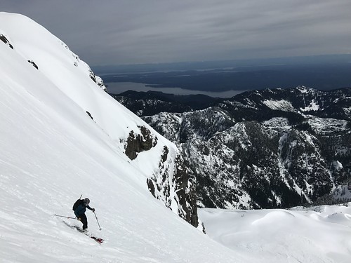
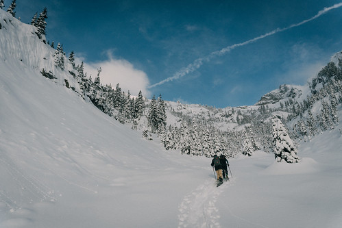
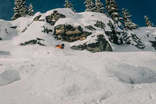
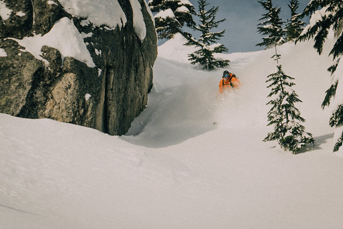
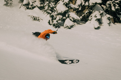
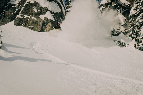
Just a quick update on early season conditions so far. We went out in Silver Basin at Crystal on Saturday. There were probably about 50 cars in the parking lot when we arrived a little after 9am. It was wanting to snow so badly while we geared up but it was coming down mostly as mixed precip.
Our group of 10 split up the Quicksilver chair line more or less in some very heavy snow that didn’t really soften until we entered the basin proper at 5600 ft. From there we followed the skin track of 5-10 other groups who were already out there attacking Three Way Peak, the King and everything in between.
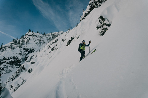
We took about three runs and several core shots before we turned around at 2pm and rode back to the parking lot. Good snow up high, still a little wet, but that will help to cover some of the sharks that are still lurking up there.
More snow this week. Fingers crossed for an early opening.
This year Tim and I decided we wanted to learn the true meaning of Labor Day so while we could have spent our three day weekend climbing anywhere we chose the Pickets, a range in the North Cascades known by climbers for its remoteness and inaccessibility. In 1931 when all of the major peaks in the Tetons had established routes the Pickets saw their first recorded technical ascent. When people talk about the wild of the North Cascades they are talking about the Pickets.
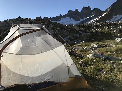
So we decided on the east ridge of Inspiration Peak, a route first climbed by Becky and company in 1958. We started from Upper Goodell Creek Campground at 10am on Saturday morning. The first 4 miles follows an overgrown road bed along the east side of the creek until it abruptly ends, signaled by a cairn and turns uphill. From there it was an unrelenting 5000 ft charge uphill on what is generously called a climbers trail. But even that doesn’t tell the full story, in a place where an approach is better measured in time rather than distance. And 8 hours later we made camp following a well traveled trail into a gravel basin at 6000 ft with a meadow at the bottom and plenty of water to make up for the lack of it on the approach. Big views of terror basin the the southern Pickets took some of the hurt off from the approach and reset our motivation.
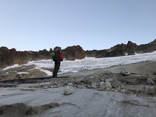
The moon was so bright at night that I woke up and ask Tim to turn off his headlamp and I saw the big dipper sitting right on top of Inspiration Peak. That must have been around midnight. Four hours later I woke up to make breakfast and by 4:45am we were on the trail picking our way around boulders and across massive rock slabs on our way up to the glacier. We tried to follow the cairns across the outlet of a lakelet and then down and across a bigger ravine that we made note of because the scramble up the other side was a little tricky but also tough to identify from the top. (note: It may be easier to swing way up high on this one and cross over the creek around 6400.)
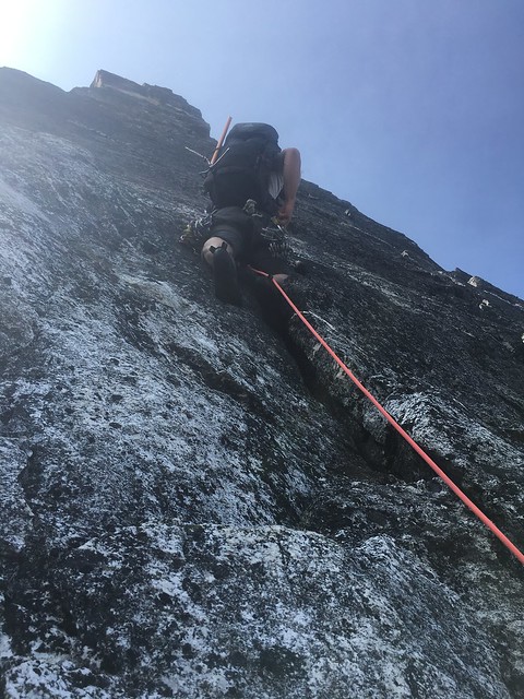
When we hit the glacier we roped up for some fairly straight forward glacier travel up until our final crevasse crossing. We navigated it by down climbing off of a snow bridge onto a lower ledge and climbing out. And then we stood at the bottom of the route, 7,400 ft above the ocean, four hours after we had started. We simul-climbed the first “two” pitches following a series of gullies and ledges trending toward a notch between the east ridge and a small spire to its right. The climbing gradually turns into a blocky face that we broke out into two 5.7 pitches as we worked our way onto the east ridge.
The next two pitches are the ones we came all the way out here for. The layback pitch starts exactly how it sounds climbing right around the roof and then straight up to a roomy belay at the bottom of a splitter hand crack. The crack climbs straight up and offers the occasional face hold but mostly excellent hand and foot jamming. At the top we cut out right aiming at the notch in the rock around the roof and then up and left to a belay.
Now through the crux we simuled the last “three” pitches to help ease the rope drag on a wandering climb across the top. From above the hand crack drop on to the north side and then up and left and around the south side of the east summit. We crossed the ridge down climbing to the base of the True summit and then and easy low fifth class scramble all the way up checking in at the top at 4pm.
Now the good part. Three double length rappels down the West Ridge. Raps are easy to find. Three more double length rappels down the gully. Lots of loose rock with very little protection offered from above. This took us 3 hours. Then we were standing at the upper glacier trying to figure how to cross a massive moat to get up on top of the snow. As it was, we climbed down underneath the glacier through a tunnel and popped out on a ledge in a crevasse. It was dusk now and we were loosing light, so with no great option to get out we front pointed straight up and out which was a less desirable approach with a lot of exposure to what lay below but ultimately better than turning around and finding another route out in the dark.
The rest of the trek back was long and circuitous in the dark, but generally uninteresting. Back at camp at 11:30pm. We had stashed a couple beers in the creek that made the hike back slightly more bearable and made dinner slightly more enjoyable.
Slept in on Monday but the smoke came in that night to punished us in the morning and then on out hike out. We made it back to the car in 6 hours. It doesn’t get much more Cascades than this. It may take awhile to forget the approach and head back into the heart of darkness that is the Pickets but we did well in honoring the holiday.
The plan was do to a Paisano Burgundy link up, but nothing that day quite went according to plan. Andrew, Tim, James and I slept at the trailhead 4mi east of WA pass, and were walking by 5:45 Saturday morning. The trail starts by scrambling down past cairns to Early Winters Creek, then weaving up through the woods to the bivy camp. The camp is roomy and has excellent views of the Liberty Bell group – next time I’ll block a few more days and plan to stay here. The trail up the spires is steep, and at times the footing is poor on marbly rocks. It is relatively easy to follow with regular cairns.
As we approached the base of Paisano around 8, it became clear that we would have to wait for a few other parties to climb before our two parties of two could jump on. Weighing our priorities for the day and recognizing that a delay may mean we couldn’t complete the link up, we decided to push on to Burgundy. We scrambled up to Burgundy Col at 7720’, roughly 3600’ above Early Winters Creek.
At the col we left our bags, and started scrambling to the base of the climb. We had planned on climbing the original route that heads directly up the north face of the spire. However we struggled significantly with route finding, and ultimately opted for what now seems to be the most popular route. This option traverses right at the top of pitch two. If I described the climb how we did it, it would be a messy and confusing string of climbing, rappelling, traversing, and so on. I will instead pitch it out how I would climb the North Face of Burgundy if I were to do it again.
P1. After scrambling slightly right and up from the col, rope up where the 5th class climbing starts about 45m above the col. Climb the right facing corner on the left side of the amphitheater without swinging around to the east side. Chossy rock. 5.7
P2. Trend back right to find a crack system with numerous flakes, ending on a large ledge. 5.8
Traverse right 50m, under a large block, to a long ledge to start the third pitch.
Belay ledge for P3
P3. Easy climbing in a left facing corner, then swing right, setting up an anchor roughly 25m above the last belay. 5.5
P4. Follow a fun corner hand crack with good pro, sling a horn and belay from a small stance at 30m. 5.8
Belay stance at top of P4
P5. Trend left, stepping around a bulge into a tapering left facing crack. A move or two of offwidth then good hands higher up, and a slightly overhanging jug to pull onto the ridge. Belay from the ridge to avoid rope drag, then scramble left to the summit.
Summit ridge
Descent: Two 60m ropes made for a relatively quick decent. We doubled up to rappel climbers left of our route to the next station. Another single rappel brought us to the ledge at the bottom of the third pitch. Rather than following our ascent path, we cut left down to a rappel station just after walking back under the large block. Three more double rappels brought us back to the col.
Tim and Andrew beat us to the same summit up the same route two days earlier, so David and I rolled into Monday with some helpful beta for the climb. In hopes of a warmer climb we opted for a later start, leaving from the trailhead at 7am. We followed the Blue Lake trail for 1.5mi, until the terrain opened up and we had views of the Liberty Bell group. From there we took the obvious climbers trail that branched left, headed up towards Concord tower. The trail dwindled, and we got off track trending too far left, getting almost to the base of Concord before cutting back right. A high traverse across snow brought us to the base of South Early Winters Spire.
There were two parties ahead of us, so we waited at the high ponderosa hoping the sun would come over the ridge soon. When the route cleared, we scrambled climber’s left to rack up at the Y-shaped larch.
Looking back up at the approach at the end of the day
P1. The crux pitch starts mellow, then has a few 5.8 moves to get past a bulge. Protects well. 5.8
P2. The Wavy Crack – quick climbing up onto a ledge, then follows a wide left facing crack. 5.8
P3. We opted for the 10.b variation, traversing right 20m to a left facing corner. The seam starts as tight fingers, then widens slightly toward the top of the corner. The climbing gets easier further into the pitch, but has some boulder moves higher up to get over a bulge. Once over the bulge, you’re on the Nervous Nelly pitch and can look up to Bear Hug. Climb through Nervous Nelly to the ledge below the Hug. 5.10b
P4. The Bear Hug – The hug itself is only about 5m of super fun climbing. Protection felt adequate with one 4 at the bottom, but the crack would have taken a 5 and a 6 higher up. From there traverse right to a large south facing corner ledge. 5.7
P5. Easy but exposed climbing on an arête, minimal pro. Stay on the right side of the arête to find a small belay stance before the base of the gully. 5.6
David belaying from the bottom of pitch 6
P6. Low 5th class, drop down and right into the sandy gully before the ridge steepens and would require a rap to get into the gully. Belay off a tree in the middle of the gully. 5.2
P7. From the notch at the top of the gully climb the obvious crack system right to the summit. 5.6
Summit photo for mom
Descent: Down the South Arête. At the top trend left to avoid dropping down the gully. There is a tight gently sloping chimney to descend, this awkward move is somewhat easier without a pack or rope on your back. Continue down the arêtes to the first of three rappel stations. After these rappels you are at the base of South Arête, and can walk back to the base of the Southwest Rib.
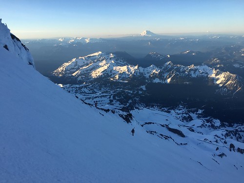
Success Glacier Couloir on Mount Rainier. A friend of a friend had heard about it.
Finding information on the route wasn’t easy; a google search pulled up a couple dated trip reports with helpful beta but very little to cross-reference against. Skiing down the south-facing couloir seemed straight-forward (and fun!) but climbing up was more like choose your own adventure. We chose the Kautz Cleaver for the ascent with two goals in mind: 1) ski the couloir, and 2) summit rainier via a traverse onto the Kautz Headwall.
We (David, Sam, myself) started Saturday morning from Paradise at 9:30 AM. Day One was largely a traverse taking us across the Nisqually, Wilson, Van Trump, and Kautz Glaciers. The route steepened when we got to the cleaver (35 to 45 degrees) and we ascended to 10,200 feet before taking up camp at a lovely bivy spot. For some reason this route just isn’t popular with the rainier masses, so we had the entire cleaver to ourselves Saturday. Party! A couple flasks were downed and the three of us retreated to the tent to rest up for summit day.
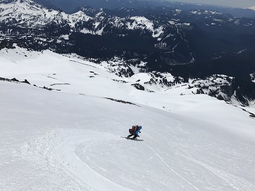
We continued up the cleaver Sunday morning at 5 and by 7 the sun was hitting most of the route. This proved to be a big problem; around 12,000 feet we started getting hit by ice pellets, which turned to ice balls, which turned to rock, one of which flew right over my head. Good karma? Bad karma? Damnit. The reality had sunk in. Our timing was off, conditions weren’t right. The good news was we were nearing the top of the couloir. The bad news was if we wanted to summit, we still had an exposed traverse over the Kautz underneath a rimy, rocky, ridge that was also likely unloading its contents onto the slopes below. A fall would be “a bummer” in the words of David Kiker. Agreed, David.
We made the safe call to fold our hand on the summit bid and focus on the ski/board down. After a quick nap at 12,800 feet, we headed down. Snow was firm up high, with some packed powder turns, turning to corned snow between 12,000 and 9,000. We did not observe any loose wet avalanches on the way down, although the snow got very rotten around 7,000 as we descended via the Van Trump, down through comet falls and eventually onto the hikers trail. This is a fun tour that is highly recommended over two days; great steep skiing and an isolated feeling.
Looking west from Seattle, The Brothers rises up from the sound to 6650 ft. The East Basin is the obvious line from the top and even from 40 miles away is clearly a sicky.
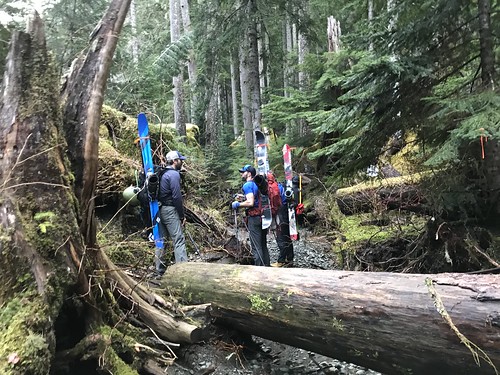
After a very wet March and April with few breaks in the weather, Easter Sunday was forecasted for sun so we camped out at the Lena Lake trailhead the night before and hit the trail at 4am for what would be a 14 hour day. The first 3.5 miles were in the dark, we reached the lake at 6am. From there the hike slowed with with several broken bridge crossings and a bit of route finding up the Valley of Silent Men.
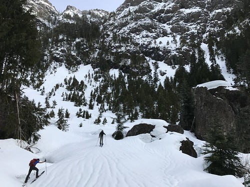
When we reached the climbers camp a little after 8am we had enough consistent snow to finally get the boards off our backs and transition to splitting. We crossed over to the west side of the creek almost immediately and traveled until we broke out of the trees into the basin. Now we had to deal with some difficult travel conditions in steep brushy terrain and sloppy snow, a lot of which had shedded into massive debris piles during the previous rain cycle.
At 5000ft the travel eased up and it was smooth sailing until 6400ft where we switched over and boot packed to the summit, topping out at 1pm. The descent was fast then slow, beginning with spring powder conditions then warming into a mush near 5000 ft. The basin itself is huge and paired with the numerous bulges, windlips and steep chutes that filter into and out of it, it offers a ton of rad skiing opportunities. At 3400 ft we switched back to skins until it was time to put them on our back and make a break for the car.
We ended up back where we started at 6pm rounding out the trip with some Milano cookies and a couple beers. I think we’ll be looking at this one for a long time once more until we decide to go for it again.
Lake Tahoe is California’s premier summer playground. Flooded with tourists longing for beachy days, boozy boat rides and immaculate mountain views, it can be a challenge to find solitude in these mountains. Winter, however, is when the real magic happens. Luckily for Mark and I people seem to shy away from the piles of snow and cooler temps of winter.
Despite the cold and stormy weather that had defined the season, cold temps were not in store for us. Lows were lingering around the high 30s and 60 degrees was going to be our top end temp for the day. With an understanding that quality snow was going to be hard to come by, we headed south from Marks squaw valley residence toward Emerald Bay. The goal was to get to some views and find a chute that’s rarely in due to waterfalls and cliffs at the terminus of the route on an average snow pack year. Average is not a word we’ve been using this year here on the west coast.
With over 600” of our favorite substance deposited by mid march, the Emerald Bay Chutes were fully in. We hoped it wouldn’t get too sun baked but when we arrived at the TH at 9:30am a couple had just come off the main descent from Jakes peak and said it was already punching through.
We started up the first pitch which was mellow and gained about 800′. Very easy cruising and no real skin track to follow as there were tracks running in every direction. Choose your own adventure.
After contemplating a route up and through some trees, an avalanche path seemed to be the most direct and avy danger was low. Wet loose was the only concern and given the terrain below we weren’t concerned about being carried a little ways if something small were to peal off. We opted to boot up most of this pitch to attain the saddle between Jakes Peak and Peak 9195′. Only a couple hundred feet of vert separated us from our peak.
Our line was along the south ridge of Peak 9195′. We’d scouted the two chutes from below and I was hot on the one further south. Mark and his new, untested boots were pushing for the more mellow north line. We made our way down to the south line to have a looksy. While on top of the glory run we had a conversation and agreed to boot back up the ridge and go for the more tame line.
Just as we unclipped to head back up the ridge, 4 skiers came tearing down towards us. Mark yells “Hey Kioki!” It was one of his ski cinematography buddies from decades ago. It seemed everywhere we went Mark knew someone. Luckily for me, Mark was easily persuaded after watching this crew go for the line.
The first couple turns were steep. Pow turned to unconsolidated mush seemed very challenging on skis. On the board I felt like I was surfing. Sub optimal ski conditions would not be the conversation piece regarding this line, however. With views of desolation wilderness to the west, Lake Tahoe and Emerald Bay to the east, it’s hard to find a zone that’s more aesthetically pleasing.
Sheer granite walls on either side gave us a wide enough chute to surf the walls of snow that had been peeling off the rock through the season. It was essentially a wide and steep natural half pipe for much of the 2000 vertical foot run. As we spit out the end, the water was roaring underneath the snow pack and it was clear that the cliffs and waterfalls would be exposing themselves within the next couple weeks.
Full of cheer, we gathered around Kioki’s van and peeled open a beer. This tour certainly left me wanting more form the region. It’s all about timing with this one but if it’s in, it’s on!
Another year, another hut trip. 2017 was the Year of the Coast Mountains in British Colombia. The Wendy Thompson Hut was nearly booked full when we decided to make reservations in late summer but we managed to score 5 days in for the beginning of March and score we did.
After a drought that seemed to last most of January and February with a few exceptions, the snow returned in a major way the week before our Saturday departure and dropped nearly 3 ft around the Duffy Lakes area and then cleared allowing a mostly sunny tour in. 4 miles and 2000 ft put us at the front door of the hut right before the clouds came back in for another storm that brought us snowfall for the rest of our trip.
Because of the recent and continuing snowfall we kept our objectives fairly conservative for the entirety of the trip, venturing into steeper terrain only a handful of times and when we did it was brief. Our use of extreme caution was rewarded with no accidents, blower powder and collective hours spent in the white room.
We managed to ski safely and that is significant, when you consider the high avalanche danger bulletin that was in effect, combined with a fatality that weekend in the greater area. The snow was definitely wanting to move while we were out and while one couple in our group did manage to break off a sizable slab about 18in deep and a few 100 ft across on the first day, we all managed to keep our noses clean.
Another one for the history books, time to start planning for next year.
Car window got smashed weeks ago, too cold to drive without it. David picks me up dark and early. We pick up where the late night text storm left off…
Where we going today? Definitely the pass. Snow is dry, low density blower. So it’s a question of how big… How far? How committed? The debate commences and hardly abates when we stop for Brian at the P&R.
The truck feels smaller now. Three egos battling for mindshare. Six eyes popping as we pass snow on the ground in North Bend. Decisions made, minds changed, decisions unmade, the same decisions made again, but this time in reverse…
Eventually we settle on the most conservative option. Pursue turns in terrain from which we can easily retreat. Dip our toe, test the temperature. I know a spot where the terrain has called me, let’s head there and see what it has to offer. And so we do…
David rules out Red: “I wouldn’t ski that with a ten foot pole”
Pushing up the first bench: Three steps forward, two steps back.
It’s deep and dry and we like it.
David projects our position on the map… These augmented reality ski goggles are really worth their weight.
David finally says “yes, I’ll ski that.”
Life is a dream.
Smoothest ride is in the backseat.
In moments like these, you’ve gotta thank the person behind the camera. This one’s for you, Brian.
What started as an idea to make a solid attempt to take on Jim Hill Mountain turned, out to be a relaxed post Christmas tour to Arrowhead Mountain. A much needed tour after a few days regaling of old Christmas past with family and friends. The weight of honey ham, seasonal meats and cheese, and a few many holiday spirits needed to escape our bodies in exchange for a solid tour.
We started out at the Henry Creek approach on the east side of US 2. Making our way to FS road 687, skinning the logging road up the twisty switch backs to the clear cut. Arrowhead Mountain was hovering above us so we knew we where headed in the right direction. After the clear cut the tight trees get thick and the trail is steep. A slight skin track was broken before us and we where able to navigate through it while noting the map to reinsure confidence in our navigation. The open ski glades started to pop out as we where skinning through the tight treed forest making our way up toward the rocky clumping to the summit of Arrowhead Mountain.
Although the tempter was only around 30F, seasonal treats might have been escaping through our skin… I was sweating like the honey ham I had for Christmas dinner! At the summit the wind chill was brisk and we quickly snacked to get over the bonk of the strenuous tour. The views are amazing from the summit, Jim Hill, Lichtenberg, Rock Mountain, Nason Ridge, etc…. I could see a passing train and hear the roar of the mighty BNSF train passing through the legendary North Cascade train tunnel!
Enough of the snacks, it was getting cold and we needed to warm up to prepare for our decent through the open glades of POW we passed while making our way to the bottom. Early season conditions do exists, so travel down with caution. Lucky for us our descent was filled with good times, and POW turns that felt bottomless. Jim Hill will come to us again with more planning and time. But for a short, steep, and rewarding tour I would recommend Arrowhead Mountain as a must tour.